Gallia County, Ohio facts for kids
Quick facts for kids
Gallia County
|
|||
|---|---|---|---|

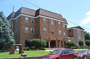
Courthouse in Gallipolis
|
|||
|
|||

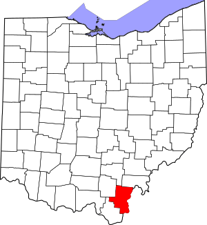
Location within the U.S. state of Ohio
|
|||
 Ohio's location within the U.S. |
|||
| Country | |||
| State | |||
| Founded | March 25, 1803 | ||
| Named for | the Latin name for France | ||
| Seat | Gallipolis | ||
| Largest village | Gallipolis | ||
| Area | |||
| • Total | 471 sq mi (1,220 km2) | ||
| • Land | 467 sq mi (1,210 km2) | ||
| • Water | 4.7 sq mi (12 km2) 1.0%% | ||
| Population
(2020)
|
|||
| • Total | 29,220 |
||
| • Density | 62/sq mi (24/km2) | ||
| Time zone | UTC−5 (Eastern) | ||
| • Summer (DST) | UTC−4 (EDT) | ||
| Congressional district | 2nd | ||
Gallia County is a county located in the state of Ohio. In 2020, about 29,220 people lived here. Its main town and largest village is Gallipolis, which is also the county seat (where the county government is located).
The county got its name from the French people who first settled here. "Gallia" is a Latin word for Gaul, an old region in Western Europe that included modern-day France. Gallia County is part of the Point Pleasant, WV-OH Micropolitan Statistical Area, which means it's a smaller city area connected to a larger one.
Contents
History of Gallia County
Gallia County was created on March 25, 1803. It was formed from parts of Adams and Washington counties. French immigrants were the first to settle in this area. They named the county "Gallia" after the Latin word for Gaul, their homeland.
In the 1800s, many people from the southern United States moved to Gallia County. They traveled by the Ohio River. Before the American Civil War, some towns in the county became places where African Americans settled. These included both free Black people and enslaved people who had escaped from the South to a free state.
In 1818, a group of people from Wales also settled in Gallia County. Because of this, Welsh was the most common second language spoken in the county until 1970.
Geography of Gallia County
Gallia County covers a total area of about 471 square miles. Most of this is land, about 467 square miles. The rest, about 4.7 square miles, is water.
Neighboring Counties
Gallia County shares its borders with several other counties:
- Vinton County (north)
- Meigs County (northeast)
- Mason County, West Virginia (east)
- Cabell County, West Virginia (south)
- Lawrence County (southwest)
- Jackson County (northwest)
Protected Natural Areas
Part of the Wayne National Forest is located within Gallia County. This is a large area of protected forest land.
Population and People
| Historical population | |||
|---|---|---|---|
| Census | Pop. | %± | |
| 1810 | 4,181 | — | |
| 1820 | 7,098 | 69.8% | |
| 1830 | 9,733 | 37.1% | |
| 1840 | 13,444 | 38.1% | |
| 1850 | 17,063 | 26.9% | |
| 1860 | 22,043 | 29.2% | |
| 1870 | 25,545 | 15.9% | |
| 1880 | 28,124 | 10.1% | |
| 1890 | 27,005 | −4.0% | |
| 1900 | 27,918 | 3.4% | |
| 1910 | 25,745 | −7.8% | |
| 1920 | 23,311 | −9.5% | |
| 1930 | 23,050 | −1.1% | |
| 1940 | 24,930 | 8.2% | |
| 1950 | 24,910 | −0.1% | |
| 1960 | 26,120 | 4.9% | |
| 1970 | 25,239 | −3.4% | |
| 1980 | 30,098 | 19.3% | |
| 1990 | 30,954 | 2.8% | |
| 2000 | 31,069 | 0.4% | |
| 2010 | 30,934 | −0.4% | |
| 2020 | 29,220 | −5.5% | |
| U.S. Decennial Census 1790-1960 1900-1990 1990-2000 2020 |
|||
Facts from the 2010 Census
In 2010, there were 30,934 people living in Gallia County. There were 12,062 households and 8,264 families. The county had about 66 people per square mile.
Most people in the county were white (94.7%). About 2.6% were Black or African American. Other groups included Asian, American Indian, and people of two or more races. About 0.9% of the population was of Hispanic or Latino background.
The average age of people in Gallia County was 39.9 years. About 31.9% of households had children under 18 living with them. The average household had 2.49 people.
Communities in Gallia County
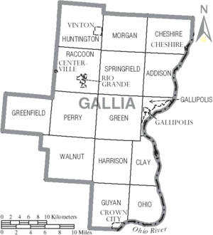
Villages
- Centerville
- Cheshire
- Crown City
- Gallipolis (the county seat)
- Rio Grande
- Vinton
Townships
- Addison
- Cheshire
- Clay
- Gallipolis
- Green
- Greenfield
- Guyan
- Harrison
- Huntington
- Morgan
- Ohio
- Perry
- Raccoon
- Springfield
- Walnut
Census-Designated Place
Unincorporated Communities
These are smaller communities that are not officially organized as villages or cities:
See also
 In Spanish: Condado de Gallia para niños
 | John T. Biggers |
 | Thomas Blackshear |
 | Mark Bradford |
 | Beverly Buchanan |


