Cheshire, Ohio facts for kids
Quick facts for kids
Cheshire, Ohio
|
|
|---|---|
|
Village
|
|

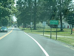
Cheshire, 2004
|
|

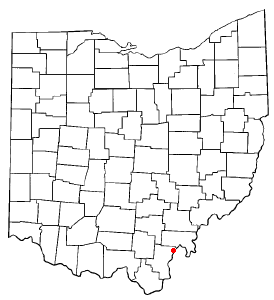
Location of Cheshire, Ohio
|
|

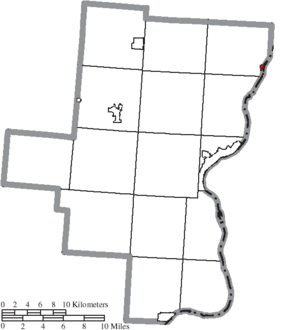
Location of Cheshire in Gallia County
|
|
| Country | United States |
| State | Ohio |
| County | Gallia |
| Township | Cheshire |
| Area | |
| • Total | 0.78 sq mi (2.03 km2) |
| • Land | 0.77 sq mi (2.00 km2) |
| • Water | 0.01 sq mi (0.03 km2) |
| Elevation | 561 ft (171 m) |
| Population
(2020)
|
|
| • Total | 123 |
| • Estimate
(2023)
|
124 |
| • Density | 159.74/sq mi (61.65/km2) |
| Time zone | UTC-5 (Eastern (EST)) |
| • Summer (DST) | UTC-4 (EDT) |
| ZIP code |
45620
|
| Area code(s) | 740 |
| FIPS code | 39-13932 |
| GNIS feature ID | 2397615 |
Cheshire is a small village in Gallia County, Ohio, United States. It is located along the Ohio River. In 2020, the population was 123 people. It is part of the quiet Point Pleasant micropolitan area.
Contents
History of Cheshire
Cheshire, Ohio, was named after Cheshire, a county in England.
Town Buyout by American Electric Power
Around the year 2000, the village faced problems from a nearby power plant. This plant, called the Gavin Power Plant, burned coal. It released toxic gas clouds and caused acid rain.
The plant's owner, American Electric Power (AEP), looked into the problems. They decided to buy the land from the villagers. This would allow them to expand the plant in the future.
In 2002, AEP made a deal with the residents. They offered about $20 million to buy out the town. Most of the 221 residents agreed to move away. They also agreed not to make future claims about their property or health. Some people chose to stay in the town.
AEP planned to tear down the buildings. They also wanted to build a dock for coal barges. However, this work has not yet started.
In 2004, the remaining villagers and people nearby decided to make the village bigger. They added properties about a mile north and west of the old village limits.
Geography
Cheshire is a small village. The United States Census Bureau says it covers about 0.78 square miles (2.03 square kilometers). Most of this area is land, about 0.77 square miles (2.00 square kilometers). A very small part, 0.01 square miles (0.03 square kilometers), is water.
Population Facts
| Historical population | |||
|---|---|---|---|
| Census | Pop. | %± | |
| 1870 | 276 | — | |
| 1960 | 369 | — | |
| 1970 | 315 | −14.6% | |
| 1980 | 297 | −5.7% | |
| 1990 | 250 | −15.8% | |
| 2000 | 221 | −11.6% | |
| 2010 | 132 | −40.3% | |
| 2020 | 123 | −6.8% | |
| 2023 (est.) | 124 | −6.1% | |
| U.S. Decennial Census | |||
2010 Census Details
In 2010, there were 132 people living in Cheshire. These people lived in 67 households. About 36 of these households were families.
The village had 76 housing units. Most people in the village were White (96.2%). A small number were African American or from other races. About 1.5% of the population was Hispanic or Latino.
About 17.9% of households had children under 18. Many households (44.8%) were married couples. Some households had a female or male head without a spouse. About 41.8% of households were single individuals. Many older people (65 or older) lived alone.
The average age in the village was 52 years old. About 15.2% of residents were under 18. About 24.2% were 65 or older. The village had slightly more males (53.0%) than females (47.0%).
Education
Students in Cheshire attend public schools. These schools are part of the Gallia County Local School District.
Notable People
- Frank Cremeans – He was a U.S. Representative from Ohio.
- Emma Rowena (Caldwell) Gatewood – She was known as "Grandma Gatewood." She was the first woman to solo thru-hike the entire Appalachian Trail.
- Harvey V. Higley – He was a businessman.
- Wendell Holmes (actor) – He was an American actor.
See also
 In Spanish: Cheshire (Ohio) para niños
 | Jessica Watkins |
 | Robert Henry Lawrence Jr. |
 | Mae Jemison |
 | Sian Proctor |
 | Guion Bluford |

