Mason County, West Virginia facts for kids
Quick facts for kids
Mason County
|
||
|---|---|---|
|
||
|
||
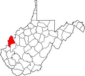
Location within the U.S. state of West Virginia
|
||
 West Virginia's location within the U.S. |
||
| Country | ||
| State | ||
| Founded | January 2, 1804 | |
| Seat | Point Pleasant | |
| Largest city | Point Pleasant | |
| Area | ||
| • Total | 445 sq mi (1,150 km2) | |
| • Land | 431 sq mi (1,120 km2) | |
| • Water | 14 sq mi (40 km2) 3.1%% | |
| Population
(2020)
|
||
| • Total | 25,453 | |
| • Estimate
(2021)
|
25,157 |
|
| • Density | 57.20/sq mi (22.084/km2) | |
| Time zone | UTC−5 (Eastern) | |
| • Summer (DST) | UTC−4 (EDT) | |
| Congressional district | 1st | |
Mason County is a county in West Virginia, a state in the United States. In 2020, about 25,453 people lived here. The main city and county seat is Point Pleasant. Mason County was started in 1804. It was named after George Mason, an important person who helped create the U.S. Constitution. Before the American Civil War, this area was part of Virginia.
Mason County is also part of the Point Pleasant, WV-OH Micropolitan Statistical Area. This means it's a smaller city area with close ties to nearby towns in West Virginia and Ohio.
Contents
Discovering Mason County's Past
Early Explorers and Claims
In 1749, a French explorer named Pierre Joseph Céloron de Blainville traveled through the Ohio Valley. He claimed this land for France. He even buried a special lead plate where the Ohio and Kanawha Rivers meet. He called this spot Point Pleasant.
The Battle of Point Pleasant
A big battle happened at Point Pleasant on October 10, 1774. Over 1,000 Virginia soldiers, led by Colonel Andrew Lewis, fought against Native American warriors. These warriors were from the Shawnee and Mingo tribes, led by Chief Cornstalk. The Virginia soldiers won the battle.
Some people in the area call this the "First Battle of the American Revolutionary War". In 1908, the U.S. Senate even approved a monument to remember it this way. However, most historians believe it was part of a different conflict called Lord Dunmore's War. White settlers may have started living here permanently around 1774. Colonel Lewis set up "Camp Point Pleasant" during the battle, and the town kept that name.
First Settlers and New Roads
The first white settlers came to the area south of Point Pleasant around 1790. One of the first was Thomas Hannan. He built a cabin and later bought land. Other families soon followed, like the Georges and Herefords.
Point Pleasant officially became a town in 1794. In 1798, Thomas Hannan built the first road through what would become Mason County. This road connected what is now St. Albans to Chillicothe, Ohio. It was a very important road for trade and travel.
Forming Mason County
The Virginia government officially created Mason County on January 2, 1804. It was named after George Mason IV, who is known as the "Father of the United States Bill of Rights". By 1810, almost 2,000 people lived in the county.
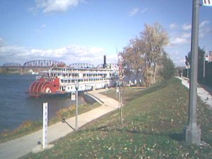
Before the American Civil War, Point Pleasant became a busy river port. Farmers could ship their goods down the Ohio and Mississippi Rivers to sell them. Coal mining also became important.
Mason County During the Civil War
During the Civil War, Mason County's representative, James H. Couch, voted against leaving the Union, even though he owned slaves. Mason County sent many men to fight for the Union army (over 1,000!). Only one company of 61 men joined the Confederate Army.
In March 1863, there was a small fight in Mason County. Confederate soldiers attacked the Mason County Courthouse, thinking there were weapons inside. Bullet holes from this attack were visible until a new courthouse was built in 1954.
Remembering History and Big Changes
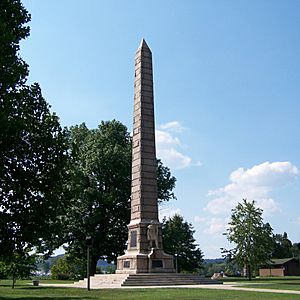
Tu-Endie-Wei State Park was opened on October 10, 1901. It remembers the Battle of Point Pleasant. The park has an old tavern from 1796 that is now a museum.
A shipbuilding company, Marietta Manufacturing Company, moved to Point Pleasant in 1915. They built ships until 1970. During World War II, a factory in Mason County made TNT. This area is now a wildlife management area and an industrial park.
Mason County had a terrible disaster on December 15, 1967. The Silver Bridge, which connected Point Pleasant to Ohio, suddenly collapsed. This accident killed 46 people and hurt nine others. It showed how important it is to check bridges often. A new bridge, the Silver Memorial Bridge, was built two years later.
In 1981, a farm that belonged to a Civil War general, John McCausland, became Smithland Farm. It is now a historic place. A River Museum opened in 2004 but closed after a fire in 2018.
Exploring Mason County's Land
Mason County covers about 445 square miles. Most of this (431 square miles) is land, and 14 square miles (about 3.1%) is water.
Major Roads in Mason County
 U.S. Route 35
 West Virginia Route 2
 West Virginia Route 62
 West Virginia Route 87
 West Virginia Route 817
Neighboring Counties
Mason County shares borders with these other counties:
- Meigs County, Ohio (north)
- Jackson County (east)
- Putnam County (southeast)
- Cabell County (southwest)
- Gallia County, Ohio (west)
Protected Natural Areas
Part of the Ohio River Islands National Wildlife Refuge is located in Mason County. This area helps protect wildlife and their homes.
People and Life in Mason County
| Historical population | |||
|---|---|---|---|
| Census | Pop. | %± | |
| 1810 | 1,991 | — | |
| 1820 | 4,868 | 144.5% | |
| 1830 | 6,534 | 34.2% | |
| 1840 | 6,777 | 3.7% | |
| 1850 | 7,539 | 11.2% | |
| 1860 | 9,173 | 21.7% | |
| 1870 | 15,978 | 74.2% | |
| 1880 | 22,293 | 39.5% | |
| 1890 | 22,863 | 2.6% | |
| 1900 | 24,142 | 5.6% | |
| 1910 | 23,019 | −4.7% | |
| 1920 | 21,459 | −6.8% | |
| 1930 | 20,788 | −3.1% | |
| 1940 | 22,270 | 7.1% | |
| 1950 | 23,537 | 5.7% | |
| 1960 | 24,459 | 3.9% | |
| 1970 | 24,306 | −0.6% | |
| 1980 | 27,045 | 11.3% | |
| 1990 | 25,178 | −6.9% | |
| 2000 | 25,957 | 3.1% | |
| 2010 | 27,324 | 5.3% | |
| 2020 | 25,453 | −6.8% | |
| 2021 (est.) | 25,157 | −7.9% | |
| U.S. Decennial Census 1790–1960 1900–1990 1990–2000 2010–2020 |
|||
In 2010, there were 27,324 people living in Mason County. There were 11,149 households, and 7,649 families. Most people (97.7%) were white. About 0.6% were Black or African American, and 0.3% were Asian.
The average age of people in Mason County was 42.4 years old. About 29.8% of households had children under 18 living with them. The average household had 2.39 people.
The average income for a household was $36,027. For families, it was $42,054. About 18.9% of all people, including 27.3% of those under 18, lived below the poverty line.
Learning in Mason County
Mason County Schools runs the public schools here. There are three junior/senior high schools, seven elementary schools, and one primary school in Mason County.
- Point Pleasant Primary School
- Ashton Elementary School
- Beale Elementary School
- Leon Elementary School
- Mason Elementary School
- Point Pleasant Intermediate School
- Roosevelt Elementary School
- Hannan Junior/Senior High School
- Point Pleasant Junior/Senior High School
- Wahama Junior/Senior High School
- New Haven Elementary School
Mason County Fair
The Mason County Fair is a very popular event! It's held every year during the first week of August at the Mason County Fair Grounds in Point Pleasant. It's the biggest county fair in West Virginia based on how many people attend.
Communities in Mason County
Cities and Towns
- Point Pleasant (This is the county seat, the main city)
- Hartford City
- Leon
- Mason
- New Haven
Magisterial Districts
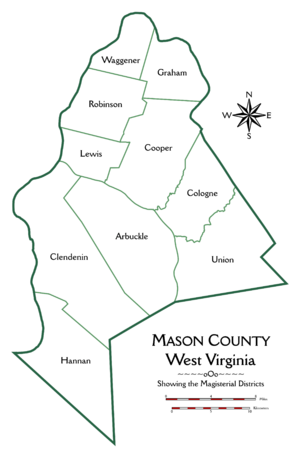
Mason County is divided into ten areas called magisterial districts. These are like smaller local government areas.
- Arbuckle
- Clendenin
- Cologne
- Cooper
- Graham
- Hannan
- Lewis
- Robinson
- Union
- Waggener
Other Communities
There are also smaller communities in Mason County:
- Apple Grove (a census-designated place)
- Gallipolis Ferry (a census-designated place)
And many unincorporated communities (smaller towns not officially governed as cities or towns):
- Ambrosia
- Arbuckle
- Arlee
- Ash
- Ashton
- Baden
- Beale
- Beech Hill
- Ben Lomond
- Capehart
- Clifton
- Condee
- Couch
- Deerlick
- Elmwood
- Fairview
- Flat Rock
- Glenwood
- Graham Station
- Greer
- Grimms Landing
- Gunville
- Henderson
- Hogsett
- Lakin
- Letart
- Maggie
- Mercers Bottom
- Mount Olive
- Nat
- Pondlick
- Rayburn
- Sassafras
- Southside
- Spilman
- Tribble
- Upland
- Waterloo
- West Columbia
- Wood
- Wyoma
Famous People from Mason County
- Gus Douglass: He was in charge of the West Virginia Department of Agriculture for a long time.
- Michael Joseph Owens: He invented a machine that could make glass bottles automatically.
See also
 In Spanish: Condado de Mason (Virginia Occidental) para niños
 | Victor J. Glover |
 | Yvonne Cagle |
 | Jeanette Epps |
 | Bernard A. Harris Jr. |


