Charge Pond facts for kids
Quick facts for kids Charge Pond |
|
|---|---|
| Location | Plymouth, Massachusetts |
| Coordinates | 41°49′00″N 70°40′35″W / 41.81667°N 70.67639°W |
| Type | Lake |
| Primary inflows | groundwater |
| Primary outflows | Harlow Brook |
| Basin countries | United States |
| Surface area | 23 acres (9.3 ha) |
| Average depth | 6 ft (1.8 m) |
| Max. depth | 17 ft (5.2 m) |
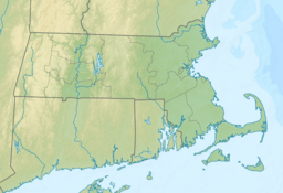
Charge Pond is a beautiful, warm water lake located in Plymouth, Massachusetts. It's a popular spot within the Myles Standish State Forest. This lake is a great example of a natural water body, fed by underground water sources.
Discover Charge Pond
Charge Pond is a medium-sized lake, covering about 23 acres (which is roughly the size of 17 football fields!). It's known for its warm water, making it pleasant for activities during warmer months. The lake isn't super deep; its average depth is about 6 feet, but it can go down to 17 feet in some spots.
Where is Charge Pond?
You can find Charge Pond in the southern part of Myles Standish State Forest. This forest is a large, protected area in Massachusetts. Charge Pond is surrounded by other smaller ponds. For example, it's south of Fearing Pond, southwest of Abner Pond, and northwest of Little Long Pond. The area around the pond is often used for camping, which makes it a fun place to visit.
How Charge Pond Gets Its Water
Charge Pond is unique because it's mainly fed by groundwater. This means water seeps into the lake from underground, rather than from a river or stream flowing into it. This natural process helps keep the lake's water clean and fresh. The lake also plays an important role as the starting point for Harlow Brook, a small stream that flows out of the pond.
 | Mary Eliza Mahoney |
 | Susie King Taylor |
 | Ida Gray |
 | Eliza Ann Grier |


