Chatham Island (Western Australia) facts for kids

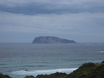
Chatham Island from Long Point at D'Entrecasteaux National Park
|
|
|
Chatham Island (Western Australia)
|
|
| Geography | |
|---|---|
| Location | Indian Ocean |
| Coordinates | 35°2′S 116°30′E / 35.033°S 116.500°E |
| Area | 0.99 km2 (0.38 sq mi) |
| Length | 1.4 km (0.87 mi) |
| Width | 0.93 km (0.578 mi) |
| Administration | |
|
Australia
|
|
| State | Western Australia |
| Region | Great Southern |
| Shire | Shire of Manjimup |
| Demographics | |
| Population | 0 |
Chatham Island is a small, special island located off the coast of Western Australia. It sits in the Indian Ocean, not far from the beautiful D'Entrecasteaux National Park. This island is very important because it is a protected nature reserve.
Where is Chatham Island?
Chatham Island is part of the Shire of Manjimup in the Great Southern region of Western Australia. It's about 1.1 kilometers (less than a mile) away from the mainland. You can find it near D'Entrecasteaux National Park and about 3 kilometers (less than 2 miles) from Mandalay Beach.
The island is quite small. It covers an area of about 106 hectares (which is about 260 acres). It's roughly 1.4 kilometers long and 0.93 kilometers wide.
A Special Nature Reserve
Since 1973, Chatham Island has been officially declared a "Class 1A Nature Reserve." This means it's a very important place for nature and is highly protected. These types of reserves help to keep the plants and animals safe and undisturbed.
How Chatham Island Got Its Name
The island was first noted by George Vancouver in 1791. He was exploring the area aboard his ship, HMS Discovery. He originally named the nearby point of land "Cape Chatham." Later, the island itself became known as Chatham Island.
 | William Lucy |
 | Charles Hayes |
 | Cleveland Robinson |


