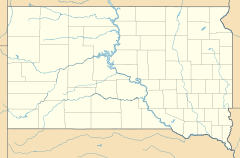
Cherry Creek, South Dakota facts for kids
Quick facts for kids
Cherry Creek, South Dakota
čhaŋpȟá wakpála
|
|
|---|---|
| Country | United States |
| State | South Dakota |
| County | Ziebach |
| Area | |
| • Total | 0.61 sq mi (1.59 km2) |
| • Land | 0.61 sq mi (1.59 km2) |
| • Water | 0.00 sq mi (0.00 km2) |
| Elevation | 1,726 ft (526 m) |
| Population
(2020)
|
|
| • Total | 282 |
| • Density | 459.28/sq mi (177.41/km2) |
| Time zone | UTC-6 (Central (CST)) |
| • Summer (DST) | UTC-5 (CDT) |
| ZIP codes |
57622
|
| Area code(s) | 605 |
| FIPS code | 46-11540 |
| GNIS feature ID | 2813069 |
Cherry Creek is a small community located in Ziebach County, South Dakota, in the United States. It's not a big city with its own local government, but rather an unincorporated community. This means it's a place where people live together, but it's usually managed by the county government instead of a separate town council.
The area is also known as a census-designated place (CDP). This just means the government counts the people living there for official records, like the 2020 census, which showed 282 people lived in Cherry Creek. The community gets its name from a nearby stream called Cherry Creek. In the Lakota language, the name for Cherry Creek is čhaŋpȟá wakpála, which means "Chokecherry Creek."
Who Lives in Cherry Creek?
Understanding Population Counts
The study of populations is called Demographics. It helps us understand how many people live in a certain area and how that number changes over time. For Cherry Creek, the most recent official count was done in 2020.
| Historical population | |||
|---|---|---|---|
| Census | Pop. | %± | |
| 2020 | 282 | — | |
| U.S. Decennial Census | |||
 | Isaac Myers |
 | D. Hamilton Jackson |
 | A. Philip Randolph |


