Chester Factory Village Historic District facts for kids
Quick facts for kids |
|
|
Chester Factory Village Historic District
|
|

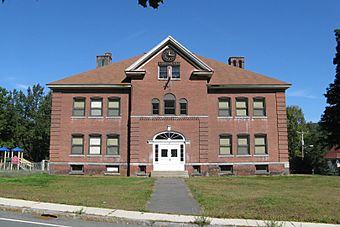
Chester Elementary School
|
|
| Location | Chester, Massachusetts |
|---|---|
| Area | 140 acres (57 ha) |
| Architectural style | Mid 19th Century Revival, Early Republic, Late Victorian |
| NRHP reference No. | 89000145 |
| Added to NRHP | March 16, 1989 |
The Chester Factory Village Historic District is a special area in Chester, Massachusetts. It's like a time capsule, preserving the old buildings and history of the village known as Chester Factories. This district helps us remember how people lived and worked long ago.
Chester was first settled in the 1760s. The village of Chester Factories was an early hub for using water power. People built mills here to grind grain (grist mills) and cut wood (sawmills).
The Story of Chester Factories
The village got its unique name from the Chester Glass Factory. This factory made glass products and was busy even during the War of 1812. It was an important part of the village's early economy.
How Roads and Trains Shaped the Village
In 1804, a new main road, called a turnpike, was built. This road, now known as United States Route 20, connected the factory village to Chester Center. This made it easier for people and goods to travel.
Around 1840, something even bigger happened: the railroad arrived! The trains needed places to stop and get supplies. Chester Factories became a key stop for these trains. This was a huge advantage for the village.
The railroad actually bypassed Chester Center. Because of this, the factory village grew more important. The town's main activities, like government and community life, slowly moved here. This is why the town hall and library were built in Chester Factories.
A Place of Growth and Industry
The Chester Factory Village Historic District was officially added to the National Register of Historic Places in 1989. This means it's recognized as a special place with important history.
The district covers a large area, about 140 acres. It includes streets like Middlefield Road, River Street, Main Street, Maple Street, US 20, and Williams Street. The old railroad tracks also mark part of its boundary.
Many older homes can be found along US 20. However, the biggest industrial growth happened near the Westfield River. This river branch runs between the main road and the old railroad tracks.
The village saw its biggest growth between 1879 and 1915. During this time, making abrasive materials (like sandpaper) became a major industry. Quarrying and cutting granite were also very important jobs.
One of the most notable buildings is Fay's Clothing Store. Built in 1896, this three-story building was the tallest in the village. It shows how busy and prosperous the village became.
 | Jewel Prestage |
 | Ella Baker |
 | Fannie Lou Hamer |


