Chestnut Grove, Tennessee facts for kids
Quick facts for kids
Chestnut Grove
|
|
|---|---|
| Country | United States |
| State | Tennessee |
| County | Perry |
| Elevation | 600 ft (200 m) |
| Time zone | UTC-6 (Central (CST)) |
| • Summer (DST) | UTC-5 (CDT) |
| GNIS feature ID | 1280382 |
Chestnut Grove is a small, quiet place located in Perry County, Tennessee in the United States. It's not a big city or a town with its own mayor and government. Instead, it's known as an "unincorporated community." This means it's a group of homes and maybe a few businesses that are part of the larger county, rather than having their own separate local government.
Contents
What is Chestnut Grove?
Chestnut Grove is a community that sits about 600 feet (which is about 183 meters) above sea level. This measurement, called its elevation, tells us how high it is compared to the ocean. It's a peaceful area where people live, work, and go to school, much like any other neighborhood, but without its own city hall or local police department.
Where is Chestnut Grove Located?
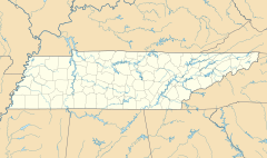
You can find Chestnut Grove in the state of Tennessee, specifically in Perry County, Tennessee. It is situated along a main road called US Route 412. If you were traveling east from the town of Linden, Tennessee, you would pass through Chestnut Grove. Its location makes it part of the beautiful landscape of central Tennessee.
What is an Unincorporated Community?
An unincorporated community like Chestnut Grove is a group of homes or businesses that don't have their own separate local government. This is different from a city or a town, which usually has its own mayor, city council, and local services like police and fire departments. For places like Chestnut Grove, services such as roads, schools, and law enforcement are typically managed by the larger county government, which in this case is Perry County, Tennessee.
Mapping Chestnut Grove
Chestnut Grove is important enough to be featured on official maps. For example, a specific section of the United States' National Map is named the "Chestnut Grove Quadrangle." A quadrangle is a rectangular area on a map, often used for detailed geographical surveys. This shows that Chestnut Grove is a recognized landmark used by mapmakers to help people find their way around and understand the local geography.
 | Aurelia Browder |
 | Nannie Helen Burroughs |
 | Michelle Alexander |


