
Choiseul Island facts for kids

Topographic map of Choiseul
|
|

Choiseul
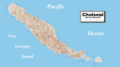
Location in Solomon Islands
Choiseul Island (off the coast of Bougainville Island, Papua New Guinea)
|
|
| Geography | |
|---|---|
| Location | Solomon Islands |
| Coordinates | 7°05′S 157°00′E / 7.08°S 157.0°E |
| Area | 2,971 km2 (1,147 sq mi) |
| Highest elevation | 1,067 m (3,501 ft) |
| Highest point | Mount Maetambe |
| Administration | |
|
Solomon Islands
|
|
| Province | Choiseul Province |
| Demographics | |
| Population | 36,719 (2020) |
Choiseul Island, also known by its local name Lauru, is the largest island in the Choiseul Province of the Solomon Islands. It covers an area of about 2,971 square kilometers. The main town for the Choiseul Province is Taro, which is located on Taro Island.
Contents
History of Choiseul Island
Early Explorers and Naming
In 1568, Spanish explorers were the first Europeans to see Choiseul Island. A small boat from their expedition, led by Pedro Ortega Valencia, discovered it. They named the island San Marcos.
Later, in 1768, a French explorer named Louis Antoine de Bougainville visited the island. He renamed it Choiseul, after the French foreign minister at that time, Étienne François, duc de Choiseul.
Colonial Times
During the 1800s, people from Choiseul Island sometimes faced a practice called "blackbirding." This was when people were often tricked or forced to work on sugar farms in places like Queensland, Australia, and Fiji.
In 1885, Germany took control of Choiseul and other islands in the North Solomon Islands. But in 1900, Germany gave these islands to the British. This was part of a deal where Britain gave up its claims to Samoa.
After the British took over, missionaries came to Choiseul. They helped most of the islanders become Christians. In the early 1900s, some British and Australian companies started large coconut farms on the island.
In 1932, an Austrian explorer and photographer named Hugo Bernatzik visited Choiseul. He studied the old customs of the islanders. He also took many photos and brought back ancient carvings, showing a culture that was changing.
World War II and Independence
During World War II, Japanese forces took control of Choiseul in 1942. In 1943, a group of US Marines carried out a special mission on the island. This mission was a raid meant to distract the Japanese from other important battles.
After the war, the Solomon Islands became an independent country in July 1978. Since then, Choiseul has been managed as part of the Choiseul Province.
Nature and Wildlife
Special Bird Area
A large part of central Choiseul Island is known as the Mount Maetambe – Kolombangara River Important Bird Area. This area is very important because it is home to many rare or unique bird species. It has a huge forest that stretches from the coast up to 800 meters high.
This forest is a great example of a "karst" limestone forest. This means the eroding limestone has created many caves and underground rivers. Mount Maetambe itself is an old volcano that is no longer active.
Some of the amazing birds found here include the Melanesian scrubfowl, crested cuckoo-doves, and red-knobbed imperial pigeons. You can also find Solomons boobooks, ultramarine kingfishers, and Solomons cockatoos. Sadly, cutting down trees (logging) is a possible threat to this special place and its wildlife.
Images for kids
-
Detailed map of Choiseul

See also
 In Spanish: Isla Choiseul para niños
- Raid on Choiseul
- New Georgia Sound
- Choiseul pigeon
