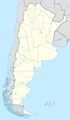
Choya, Argentina facts for kids
Quick facts for kids
Choya
|
|
|---|---|
|
Municipality and village
|
|
| 27°52′21″S 66°38′28″W / 27.87250°S 66.64111°W | |
| Country | |
| Province | Catamarca Province |
| Department | Andalgalá |
| Elevation | 3,691 ft (1,125 m) |
| Population
(2001)
|
|
| • Total | 403 |
| Time zone | UTC−3 (ART) |
| Postal code |
K4741
|
| Area code(s) | 03835 |
Choya is a small village and municipality in the Catamarca Province of northwestern Argentina. It's part of the Andalgalá Department. You can find Choya along National Route 47, and it's also located near the Choya River.
Contents
Discovering Choya's Past
Early Records and People
Choya has a long history, with its name appearing in old Spanish records from the time of the colonies. In 1660, a leader named Alonso Mercado y Villacorta, who was the Governor of Rio de la Plata, gave some people the job of managing the native communities in the Andalgalá valley.
- One of these managers was Gregorio de Villagra.
- Later, in 1674, several families of native Ingamana people settled in Choya.
Ancient Artifacts and Discoveries
Scientists have studied a special place in Choya called Choya 68. They dug up pieces of old pottery there. These pottery pieces are called Aguada Portezuelo ceramic artifacts.
- Using a method called radiocarbon dating, scientists found that these artifacts are about 1000 years old.
- This tells us that people lived in Choya a very long time ago!
Community and Mining Projects
Choya is located south of the Capillitas mine. The area has seen some large mining projects, like the MARA project. This project aimed to extract valuable resources from the land.
- Sometimes, when big projects start, local people have concerns about their land and way of life.
- Citizens from Choya and nearby areas shared their views about these mining plans.
- The government wanted to boost the economy in the area through mining.
How to Get Around Choya
Roads Connecting Communities
In the 20th century, a road called National Route 63 was built. This road helped connect the town of Capillitas to the city of Andalgalá. It was a long, unpaved road, about 104 kilometers (65 miles) long.
- Choya was an important stop along this route.
- Later, in 1980, the name of the road was changed.
- National Route 63 became known as National Route 47, which is its name today.
Nature and Wildlife Around Choya
Studying Local Animals
Scientists are interested in the animals that live in and around Choya. From March 1990 to January 1991, they studied a type of animal called the gray leaf-eared mouse.
- They collected samples from these mice in the Choya area.
- This research helped them learn about the genetic differences among these mice.
See also
 In Spanish: Choya (Catamarca) para niños


