Coalwood, Montana facts for kids
Quick facts for kids
Coalwood
|
|
|---|---|
| Country | United States |
| State | Montana |
| County | Powder River |
| Elevation | 3,347 ft (1,020 m) |
| Time zone | Mountain (MST) |
| • Summer (DST) | MDT |
| Area code(s) | 406 |
| GNIS feature ID | 770001 |
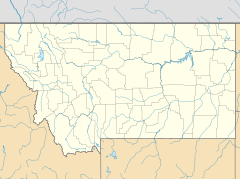
Coalwood is a small, unincorporated community located in northern Powder River County, Montana, in the United States. An "unincorporated community" means it's a place where people live, but it doesn't have its own local government like a city or town. It lies along Montana Highway 59, about 23.5 miles (37.8 km) north of Broadus, which is the main town and county seat of Powder River County.
Where is Coalwood?
Coalwood is located in the beautiful state of Montana. It sits about 3,340 feet (which is about 1,018 meters) above sea level. Imagine being high up, close to the clouds! The community is in the Mountain Time Zone, which means it observes Daylight saving time, just like many other places. If you ever need to call someone there, the area code is 406.
What's the Weather Like?
Coalwood has what is called a semi-arid climate. This might sound fancy, but it just means the area is quite dry. It gets less rain than other places, but it's not as dry as a desert. It's often sunny, with clear skies!
A Look Back in Time: Coalwood's History
Coalwood was first started in 1910. Back then, it was part of a different area called Custer County. Later, in 1919, a new county was created called Powder River County. Coalwood then became part of this new county, with the town of Broadus as its main center.


