Custer County, Montana facts for kids
Quick facts for kids
Custer County
|
|
|---|---|

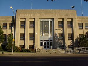
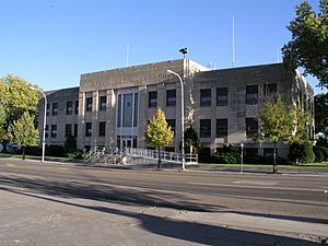
Custer County Courthouse of Art Deco style architecture of the 1930s era, in the county seat and largest town of Miles City
|
|

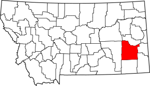
Location within the U.S. state of Montana
|
|
 Montana's location within the U.S. |
|
| Country | |
| State | |
| Founded | June 2, 1865 |
| Named for | George Armstrong Custer (1839-1876) |
| Seat | Miles City |
| Largest city | Miles City |
| Area | |
| • Total | 3,793 sq mi (9,820 km2) |
| • Land | 3,783 sq mi (9,800 km2) |
| • Water | 9.9 sq mi (26 km2) 0.3% |
| Population
(2020)
|
|
| • Total | 11,867 |
| • Estimate
(2022)
|
12,032 |
| • Density | 3.1287/sq mi (1.20798/km2) |
| Time zone | UTC−7 (Mountain) |
| • Summer (DST) | UTC−6 (MDT) |
| Congressional district | 2nd |
| Website | https://custercountymt.com/ |
|
|
Custer County is a county in the southeastern part of Montana, a state in the United States. In 2020, about 11,867 people lived there. The main town and county seat is Miles City.
The county was created on June 2, 1865, right after the American Civil War ended. It was one of the first nine counties in the new Montana Territory. This territory was formed in 1864 by the United States Congress and approved by President Abraham Lincoln.
Custer County was first called Big Horn County. It was renamed on February 16, 1877. The new name honored Lieutenant Colonel George Armstrong Custer. He was a commander of the 7th United States Cavalry. He died in the Battle of the Little Bighorn in June 1876. This battle was part of the American Indian Wars.
Contents
Exploring Custer County's Location and Features
Custer County is located in the southeast of Montana. The United States Census Bureau says the county covers about 3,793 square miles. Most of this area, about 3,783 square miles, is land. The rest, about 9.9 square miles, is water.
What is the Climate Like in Custer County?
Custer County has a mostly cold semi-arid climate. This means it's often dry and can have cold winters. On climate maps, this type of weather is shown as "BSk".
Main Roads in Custer County
These are the major roads that help people travel through Custer County:
Public Transportation Options
- Jefferson Lines is a bus service that operates in the area.
Neighboring Counties of Custer County
Custer County shares its borders with several other counties:
- Prairie County to the north
- Fallon County to the east
- Carter County to the southeast
- Powder River County to the south
- Rosebud County to the west
- Garfield County to the northwest
Who Lives in Custer County?
In 2020, the population of Custer County was 11,867 people. In 2010, there were 11,699 people living there. The county had 5,031 households at that time.
Most people in the county were white (95.5%). About 1.7% were American Indian. A small number of people were from other backgrounds. About 2.2% of the population was of Hispanic or Latino origin.
The average age of people in Custer County in 2010 was 42.1 years old.
What Drives Custer County's Economy?
The main parts of Custer County's economy are dryland farming and raising cattle. Miles City is a very important business hub for the surrounding area. It serves towns and communities up to 100 miles away.
In 2009, some of the biggest employers in the county included Holy Rosary Healthcare, Sanjel USA, Stockman Bank, and Walmart.
Towns and Places in Custer County
City
- Miles City (This is the main town and where the county government is located.)
Town
Smaller Communities Without City Government
These are other places where people live in Custer County:
See also
 In Spanish: Condado de Custer (Montana) para niños
 | Janet Taylor Pickett |
 | Synthia Saint James |
 | Howardena Pindell |
 | Faith Ringgold |


