Carter County, Montana facts for kids
Quick facts for kids
Carter County
|
|
|---|---|

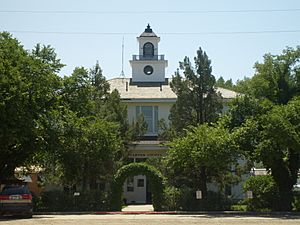
Carter County Courthouse in Ekalaka
|
|

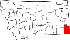
Location within the U.S. state of Montana
|
|
 Montana's location within the U.S. |
|
| Country | |
| State | |
| Founded | 1917 |
| Named for | Thomas H. Carter |
| Seat | Ekalaka |
| Largest town | Ekalaka |
| Area | |
| • Total | 3,348 sq mi (8,670 km2) |
| • Land | 3,341 sq mi (8,650 km2) |
| • Water | 7.5 sq mi (19 km2) 0.2% |
| Population
(2020)
|
|
| • Total | 1,415 |
| • Estimate
(2022)
|
1,382 |
| • Density | 0.42264/sq mi (0.16318/km2) |
| Time zone | UTC−7 (Mountain) |
| • Summer (DST) | UTC−6 (MDT) |
| Congressional district | 2nd |
|
|
Carter County is a county located in the U.S. state of Montana. It is in the southeastern part of the state. In 2020, about 1,415 people lived here. This makes it one of the least populated counties in Montana. The main town and county seat is Ekalaka.
Contents
History of Carter County
Carter County got its name from Thomas Henry Carter. He was the first person to represent Montana in the U.S. Congress. Before settlers arrived, the Sioux tribe lived on this land. The county was officially created in 1917.
Geography and Nature
Carter County covers a large area of about 3,348 square miles. Most of this area is land, with a small amount of water.
Medicine Rocks State Park
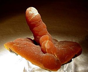
Medicine Rocks State Park is a special place in Carter County. It is about 14 miles north of Ekalaka. The rocks there have unique shapes because of how the weather has changed them over time. Native American hunting parties used this site long ago.
Neighboring Counties
Carter County shares borders with several other counties:
- Powder River County to the west
- Custer County to the northwest
- Fallon County to the north
- Harding County, South Dakota to the east
- Butte County, South Dakota to the southeast
- Crook County, Wyoming to the south
Protected Areas
Part of the Custer National Forest is located within Carter County. This forest helps protect nature and wildlife.
People of Carter County
| Historical population | |||
|---|---|---|---|
| Census | Pop. | %± | |
| 1920 | 3,972 | — | |
| 1930 | 4,136 | 4.1% | |
| 1940 | 3,280 | −20.7% | |
| 1950 | 2,798 | −14.7% | |
| 1960 | 2,493 | −10.9% | |
| 1970 | 1,956 | −21.5% | |
| 1980 | 1,799 | −8.0% | |
| 1990 | 1,503 | −16.5% | |
| 2000 | 1,360 | −9.5% | |
| 2010 | 1,160 | −14.7% | |
| 2020 | 1,415 | 22.0% | |
| 2022 (est.) | 1,382 | 19.1% | |
| U.S. Decennial Census 1790–1960, 1900–1990, 1990–2000, 2010–2020 |
|||
Population in 2020
In 2020, Carter County had 1,415 people living in 628 homes. Most people were White. A small number were Native American or from other backgrounds. About half of the population was female and half was male.
Most people over 16 years old had jobs. Over 90% of the people had finished high school. Many homes in the county had computers and internet access.
Towns and Communities
Carter County has one main town and several smaller communities.
Main Town
- Ekalaka is the largest town and the county seat.
Other Communities
- Alzada is a census-designated place. This means it is a community recognized by the census.
Small Villages
Several smaller, unincorporated communities are also in the county:
Past Communities
- Capitol was once a community in Carter County.
See also
 In Spanish: Condado de Carter (Montana) para niños
 | Laphonza Butler |
 | Daisy Bates |
 | Elizabeth Piper Ensley |


