Conímbriga facts for kids
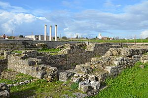
A view of the ruins of the Roman settlement of Conímbriga
|
|
| Alternative name | Ruins of Conímbriga |
|---|---|
| Location | Coimbra, Baixo Mondego, Centro, Portugal |
| Coordinates | 40°5′58″N 8°29′26″W / 40.09944°N 8.49056°W |
| Type | Ruins |
| Site notes | |
| Archaeologists | unknown |
| Ownership | Portuguese Republic |
| Public access | Public Ramal da EN342, near the village of Condeixa-a-Velha |
Conímbriga is one of the biggest Roman cities ever found in Portugal. It became a National Monument in 1910, which means it's a very important historical site.
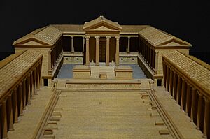
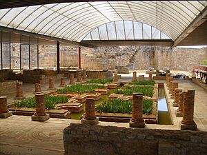
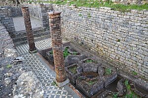
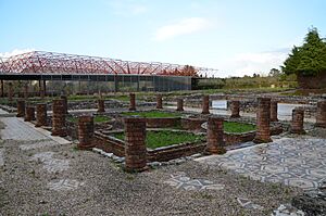
This ancient city is located near the town of Condeixa-a-Nova, about 16 kilometers (10 miles) from Coimbra. It was once a busy, walled city with many buildings. These included a main square (forum), large public buildings (basilica), shops, and public baths. There were also homes, from simple apartments (insulae) to grand houses (domus) with inner courtyards. One famous house is called the Casa dos Repuxos, known for its fountains.
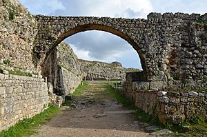
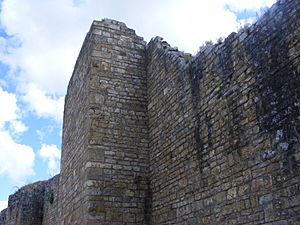
Conímbriga was protected by strong stone walls, about 1,500 meters (4,900 feet) long. Visitors can still see the remains of these walls and the gates that once guarded the city. Today, there's a special visitors' center where you can see amazing objects found by archaeologists. These include old coins, tools, and pottery, giving us a peek into daily life long ago.
Contents
Exploring Conímbriga's Past
Ancient Beginnings
Conímbriga has a long history, starting around 900 BCE. At first, people from the Castro culture lived here. Later, the Conii people, who were native to the area, made it their home. The name "Conímbriga" comes from their language, meaning "place of rocky height," combined with a Celtic word for "citadel."
The city was an important stop on a road connecting other major Roman towns. Around 139 BCE, the Romans arrived. They brought their way of organizing cities and building. Because the area was peaceful, the local people quickly adopted Roman customs and language. Conímbriga grew into a rich and busy Roman town.
Between 69 and 79 CE, during the time of Emperor Vespasian, Conímbriga became an official Roman city, called a municipium. This meant it had its own government. At this time, the city was rebuilt with new plans. It's thought that about 10,600 people lived there, judging by the size of its amphitheater. Many Roman families moved here and mixed with the local people.
Later, in the 2nd century, the famous Casa dos Repuxos (House of Fountains) was built. Towards the end of the 3rd century, the city's walls were made stronger. Many large homes were built, and a Christian church (basilica) was added in the 4th century. Sadly, between 465 and 468 CE, invaders called the Sueves attacked and destroyed the city. Many people were taken as slaves.
From Middle Ages to Modern Discoveries
After the Roman era, Conímbriga's importance faded. By 589 CE, the main church leadership moved to nearby Aeminium, which later became Coimbra.
For many centuries, the ruins were mostly forgotten. In the 18th century, people started to notice the ancient site again. In 1873, the first official digs began. Archaeologists started to uncover beautiful mosaics and learn about the city's layout.
Uncovering the Roman City
In the early 1900s, more serious studies of Conímbriga began. In 1930, the Portuguese government bought land around the ruins to protect them. This led to more excavations and work to rebuild and strengthen the ancient structures.
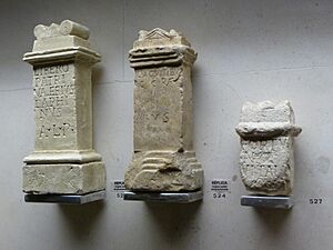
In 1962, the Conímbriga Monographic Museum opened. This museum displays many of the treasures found at the site. Later, experts from the University of Bordeaux joined the Portuguese team to uncover the heart of the Roman city.
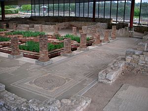
Throughout the 1970s and 1980s, work continued to restore the ruins, expand the museum, and make the site better for visitors. A new roof was even put over the Casa dos Repuxos in 1986 to protect its amazing mosaics. In the 1990s and early 2000s, there were more projects to improve the museum and visitor facilities.
What Conímbriga Looked Like
Conímbriga is built on a triangular plateau, surrounded by two deep valleys. Even though it wasn't the biggest Roman city in Portugal, it is the best preserved. Experts believe that only about 10% of the city has been dug up so far!
City Layout and Buildings
The city changed over time, from the Iron Age to the 5th century.
- Early Roman Period: In the 1st century BC, there was a main square (forum), public baths, and an aqueduct to bring water.
- Later Roman Period: In the 1st century AD, the main square was rebuilt, and new baths were added. The city plan was updated.
- Late Roman Period: In the 3rd century, new, stronger walls were built, making the city smaller and easier to defend.
Many homes were found, including multi-story houses (insulae) with open courtyards. There were also grand private homes (domus) with gardens.
The House of Cantaber
One of the largest private homes is the House of Cantaber. Cantaber was a very important person in the city in the 5th century. His house was huge, over 3,260 square meters (35,000 square feet), with 40 rooms! It even had a hypocaust, which was an ancient heating system. Hot air from a furnace flowed under the floors and through the walls to warm the house. Sadly, Cantaber was killed in his home by invaders, and his family was taken away.
Decorations and Public Baths
Many buildings in Conímbriga were beautifully decorated. They had colorful mosaics on the floors, sculptures, and painted murals on the walls.
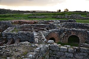
The city had three main public bath complexes: the Great Southern Baths, the Baths of the Wall, and the Baths of the Aqueduct. You can still see the stone channels under the floors where hot air used to circulate, heating the water and rooms.
The Amphitheater and City Walls
Conímbriga also had a large amphitheater, built into a natural dip in the land. It could hold about 5,000 people! Parts of it were found under modern homes.
The city walls are very strong and look like they were built quickly. They are made of large, rough stones, many taken from other buildings. The walls are about 5 to 6.5 meters (16 to 21 feet) high. This shows how important defense became as the Roman Empire faced more attacks.
See also
 In Spanish: Conímbriga para niños
- Aeminium
- Lusitania
 | Sharif Bey |
 | Hale Woodruff |
 | Richmond Barthé |
 | Purvis Young |


