Concepción District, San Rafael facts for kids
Quick facts for kids
Concepción
|
|
|---|---|
|
District
|
|
| Country | |
| Province | Heredia |
| Canton | San Rafael |
| Area | |
| • Total | 22.67 km2 (8.75 sq mi) |
| Elevation | 1,490 m (4,890 ft) |
| Population
(2011)
|
|
| • Total | 6,077 |
| • Density | 268.06/km2 (694.28/sq mi) |
| Time zone | UTC−06:00 |
| Postal code |
40505
|
Concepción is a district located in the San Rafael area. It is part of the Heredia province in Costa Rica. Think of a district as a smaller part of a larger region.
Contents
Exploring Concepción's Geography
Concepción covers an area of about 22.67 square kilometers. To help you imagine, that's roughly the size of 2,267 football fields! The district is located at an elevation of 1,490 meters above sea level. This means it's quite high up, which can affect its climate and landscape.
Understanding Concepción's Population
This section tells us about the number of people living in Concepción over time. This is called demographics.
| Historical population | |||
|---|---|---|---|
| Census | Pop. | %± | |
| 1892 | 359 | — | |
| 1927 | 756 | 110.6% | |
| 1950 | 994 | 31.5% | |
| 1963 | 1,245 | 25.3% | |
| 1973 | 1,527 | 22.7% | |
| 1984 | 1,914 | 25.3% | |
| 2000 | 4,158 | 117.2% | |
| 2011 | 6,077 | 46.2% | |
|
Instituto Nacional de Estadística y Censos |
|||
According to the 2011 census, Concepción had a population of 6,077 people. This information helps us see how the district has grown over the years.
Getting Around: Transportation in Concepción
This part explains how people and goods move around Concepción.
Road Transportation in the District
The district has specific roads that help people travel. One important road is:
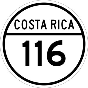
- National Route 116
This route connects Concepción to other places, making it easier for residents to commute and for businesses to operate.
See also
 In Spanish: Concepción de San Rafael para niños
 | Delilah Pierce |
 | Gordon Parks |
 | Augusta Savage |
 | Charles Ethan Porter |


