
Coordinate system facts for kids
A coordinate system is like a special map that uses numbers to show the exact spot of anything. Imagine you're trying to tell a friend exactly where your favorite toy is. You might say, "It's on the third shelf, two books from the left." That's a simple way to use coordinates! In math and science, we use numbers to pinpoint locations. For flat surfaces (like a piece of paper), we usually need two numbers. For spaces that have depth (like a room), we need three numbers.

Contents
What is a Coordinate System?
A coordinate system gives every single point a unique set of numbers. Think of it like an address for a location. Just as your house has a unique address, every point in a coordinate system has its own unique "number address." These numbers are called coordinates.
Why Do We Need Them?
Coordinate systems are super important because they help us describe locations precisely. Without them, it would be really hard to:
- Tell someone exactly where a treasure is buried.
- Program a robot to move to a specific spot.
- Draw accurate maps.
- Design buildings or machines.
- Track satellites in space.
The Cartesian Coordinate System
The most common type of coordinate system you'll probably learn about is the Cartesian coordinate system. It's named after a French mathematician and philosopher named René Descartes.
How It Works
In a 2D (two-dimensional) Cartesian system, you have two main lines that cross each other at a right angle (like the corner of a square).
- One line goes left and right; this is called the x-axis.
- The other line goes up and down; this is called the y-axis.
- The point where these two lines cross is called the origin. Its coordinates are (0,0).
To find a point, you first go along the x-axis (left or right), and then you go up or down along the y-axis. A point is written as (x, y). For example, (3, 2) means you go 3 steps right from the origin, then 2 steps up.
Real-World Uses of Cartesian Coordinates
- Graphing: When you draw graphs in math class, you're using a Cartesian system to plot points and lines.
- Video Games: Characters and objects in video games move around using x and y coordinates.
- City Maps: Many city maps use a grid similar to a Cartesian system to help you find places. Imagine streets running east-west (x-axis) and avenues running north-south (y-axis).
Other Cool Coordinate Systems
While the Cartesian system is very popular, other coordinate systems are better for different situations.
Polar Coordinate System
Instead of using x and y, the polar coordinate system uses a distance and an angle.
- You pick a central point (the "pole").
- You measure the distance from the pole to your point (called the radius or 'r').
- You also measure the angle from a starting line (like the x-axis) to your point (called the angle or 'θ' - theta).
So, a point in polar coordinates is written as (r, θ).
When to Use Polar Coordinates
Polar coordinates are great for things that move in circles or spirals.
- Radar Systems: Radar screens often show targets using their distance and angle from the radar dish.
- Robotics: A robot arm that swings and extends might use polar coordinates to know where its hand is.
- Sound Waves: Describing how sound spreads out from a source can be easier with polar coordinates.
Spherical Coordinate System
For things in 3D space, like finding a spot on Earth, we often use a spherical coordinate system. This is similar to how we use latitude and longitude.
- It uses a distance from a central point (like the Earth's center).
- It uses two angles: one for "up and down" (like latitude) and one for "around" (like longitude).
Where You See Spherical Coordinates
- Navigation: GPS systems use a form of spherical coordinates (latitude, longitude, and altitude) to pinpoint locations on Earth.
- Astronomy: Astronomers use spherical coordinates to locate stars and planets in the sky.
Related pages
Images for kids
-
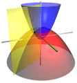
Coordinate surfaces of the three-dimensional paraboloidal coordinates.

See also
 In Spanish: Sistema de coordenadas para niños
