Corn Creek, South Dakota facts for kids
Quick facts for kids
Corn Creek, South Dakota
|
|
|---|---|
| Country | United States |
| State | South Dakota |
| County | Mellette |
| Area | |
| • Total | 2.09 sq mi (5.42 km2) |
| • Land | 2.03 sq mi (5.26 km2) |
| • Water | 0.06 sq mi (0.16 km2) |
| Elevation | 2,365 ft (721 m) |
| Population
(2020)
|
|
| • Total | 113 |
| • Density | 55.69/sq mi (21.50/km2) |
| Time zone | UTC-6 (Central (CST)) |
| • Summer (DST) | UTC-5 (CDT) |
| Area code(s) | 605 |
| GNIS feature ID | 1266592 |
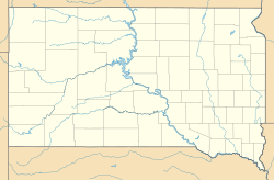
Corn Creek is a small community in Mellette County, South Dakota, in the United States. It's called an unincorporated community because it doesn't have its own local government like a city or town. It is also a census-designated place, which means the U.S. Census Bureau counts its population separately.
In 2020, 113 people lived in Corn Creek. The community is found where South Dakota Highway 44 and South Dakota Highway 63 meet.
Geography of Corn Creek
Corn Creek covers a total area of about 2.1 square miles (5.4 square kilometers). Most of this area is land. A smaller part, about 0.06 square miles (0.16 square kilometers), is water. This information comes from the U.S. Census Bureau.
Population of Corn Creek
The population of Corn Creek was counted in the 2020 census.
| Historical population | |||
|---|---|---|---|
| Census | Pop. | %± | |
| 2020 | 113 | — | |
| U.S. Decennial Census | |||
Education in Corn Creek
Students in Corn Creek attend schools that are part of the White River School District 47-1.
See also
 In Spanish: Corn Creek (Dakota del Sur) para niños
 | Frances Mary Albrier |
 | Whitney Young |
 | Muhammad Ali |


