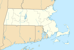
Coskata, Massachusetts facts for kids
Quick facts for kids
Coskata, Massachusetts
|
|
|---|---|
|
Village
|
|
| Country | United States |
| State | Massachusetts |
| County | Nantucket |
| Elevation | 3 ft (0.9 m) |
| Time zone | UTC-5 (Eastern (EST)) |
| • Summer (DST) | UTC-4 (EDT) |
| GNIS feature ID | 616850 |
Coskata is a small community, or village, located in Nantucket, Massachusetts, in the United States. It is also known by other names like Coskaty, Cross Katy, or Koskata Head. This village is very close to the ocean, with an elevation of only 3 feet (about 1 meter) above sea level. You can find Coskata about 2 miles (3 km) northwest of another place called Wauwinet. Its exact location is at coordinates 41.3542871 degrees north and -70.0202925 degrees west.
Contents
What is a Village?
A village is a type of human settlement. It is usually smaller than a town or a city. Villages often have a close-knit community. People in villages might know many of their neighbors.
How Villages are Different
Villages are typically rural. This means they are in the countryside. They have fewer buildings and more open spaces. They might not have as many services as a big city.
Life in a Village
Life in a village can be quieter. There might be less traffic and noise. Many villages are known for their natural beauty. They offer a peaceful way of life.
Coskata's Location in Massachusetts
Coskata is part of Nantucket. Nantucket is an island off the coast of Massachusetts. Massachusetts is a state in the northeastern United States. It is known for its history and beautiful coastline.
Exploring Nantucket Island
Nantucket Island is famous for its beaches. It also has historic lighthouses. The island is a popular spot for tourists. Many people visit to enjoy the ocean and charming towns.
Coastal Living in Massachusetts
Being a coastal village, Coskata is near the Atlantic Ocean. Coastal areas often have unique plants and animals. They also experience different weather patterns. The ocean plays a big role in daily life.
Geography and Elevation
Coskata's elevation is very low. It is only 3 feet above sea level. This low elevation is common for places right on the coast. It means the land is very flat near the water.
Understanding Elevation
Elevation tells us how high a place is. It is measured from sea level. Sea level is the average height of the ocean's surface. Places with low elevation are often near large bodies of water.
Why Low Elevation Matters
Low elevation can affect a place. It might be more exposed to ocean winds. It could also be more likely to experience flooding. This is especially true during big storms or high tides.
Coordinates and Mapping
The coordinates for Coskata are 41 degrees, 21 minutes, 15 seconds North. They are also 70 degrees, 1 minute, 13 seconds West. These numbers help us find its exact spot on a map.
What are Coordinates?
Coordinates are like an address for a place on Earth. They use lines of latitude and longitude. Latitude lines run east to west. Longitude lines run north to south.
Using Coordinates to Find Places
With coordinates, anyone can pinpoint a location. This is useful for navigation. It also helps scientists study different areas. Maps and GPS devices use coordinates all the time.


