County Farm Bridge (Dover, New Hampshire) facts for kids
Quick facts for kids |
|
|
County Farm Bridge
|
|

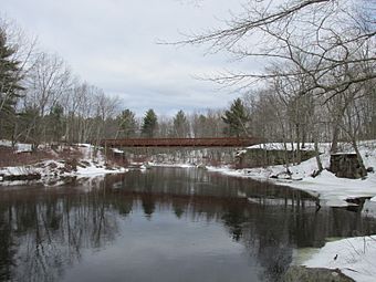
Pedestrian bridge and old abutments
|
|
| Location | end of County Farm Rd., Dover, New Hampshire |
|---|---|
| Area | 0.1 acres (0.040 ha) |
| Built | 1875 |
| Architectural style | Howe Truss |
| NRHP reference No. | 75000237 |
| Added to NRHP | May 21, 1975 |
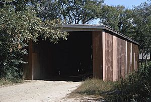
The County Farm Bridge was a special kind of bridge called a covered bridge in Dover, New Hampshire. It stretched over the Cochecho River. This bridge was built around 1875 using a strong design called a Howe truss. It was very important because it helped people get to the nearby county farm. Sadly, a fire destroyed the bridge in 1981. Today, a new bridge for people walking and biking stands in its place. Because of its history, the County Farm Bridge was added to the National Register of Historic Places in 1975.
Contents
The County Farm Bridge: A Look Back
The County Farm Bridge was once a famous landmark. It was known for its unique design and its role in the local community. This bridge was a great example of old-time engineering.
Where Was This Historic Bridge?
The County Farm Bridge was located in a quiet, rural area of western Dover. It was right next to a large county complex. This complex included a county prison and other buildings. The bridge crossed the Cocheco River, which winds around the county complex.
What Was a Howe Truss Bridge?
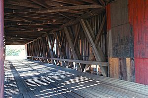
The County Farm Bridge was a single-span Howe truss structure. A Howe truss is a type of bridge design. It uses a pattern of wood and metal parts. These parts are arranged in triangles. This design makes the bridge very strong and stable.
The bridge was about 112.5 feet (34.3 meters) long. It had a roof that was not very steep. The outside of the bridge was covered with vertical wooden boards. These boards protected the inside of the bridge from the weather.
Why Was the Bridge Important?
The County Farm Bridge was built around 1875. It was the first bridge ever built at that spot. It was created to serve the county complex. This complex had been set up in 1866. The bridge helped people and supplies get to and from the farm.
In 1963, the stone supports of the bridge were made even stronger. Workers added concrete piers and steel beams. This helped the bridge last longer. In 1972, the bridge's ownership changed. It went from the county to the city of Dover.
What Happened to the County Farm Bridge?
Sadly, the County Farm Bridge was destroyed by fire in 1981. It was a big loss for the community. After the fire, a new structure was built in its place. This new bridge is for pedestrians, meaning people who are walking or biking. It is a multi-use path that connects the area.


