County of Balurga facts for kids
The County of Balurga is a special way of dividing land in Queensland, Australia. Think of it like an old-fashioned map section. These divisions are called cadastral divisions. They help the government keep track of land for things like ownership and planning.
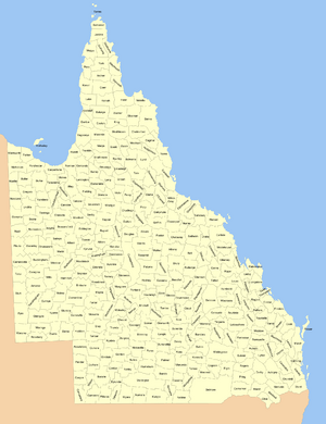
Balurga is located in a part of Queensland called Far North Queensland. It's found east of a town called Kowanyama, on the famous Cape York Peninsula.
Contents
What is the County of Balurga?
A county is a type of area used for administrative purposes. It's like a big block on a map. In Queensland, these counties were created a long time ago to help manage land. They are not the same as the local government areas we have today, but they were very important for mapping and land records in the past.
Where is Balurga Located?
The County of Balurga is in the northern part of Queensland. This area is known for its wild and beautiful landscapes. It's part of the huge Cape York Peninsula, which is the northernmost tip of Australia. The nearest town mentioned is Kowanyama, which is to the west of Balurga.
How Was Balurga Created?
The County of Balurga, along with many other counties in Queensland, was officially created on March 7, 1901. This happened when the Governor made a special announcement. This announcement was based on a law called the Land Act 1897. This law helped to legally divide Queensland into these specific land areas. The borders of Balurga were carefully described, using other counties and land blocks as markers.
Dividing the Land: Parishes
Just like a county is a big division, it can also be split into smaller parts. These smaller parts are called civil parishes.
What are Parishes?
Within a county, a parish is an even smaller section of land. These divisions were also used for administrative reasons, helping to organize land even more precisely. Each parish has its own name and specific boundaries.
Parishes in Balurga
The County of Balurga is divided into several civil parishes. Each parish is part of the Shire of Cook, which is a local government area. A Shire is like a local council that manages services for a region. Here are the parishes within Balurga:
| Parish | Local Government Area | Coordinates |
|---|---|---|
| Balurga | Cook | 14°55′S 142°15′E / 14.917°S 142.250°E |
| Cloughton | Cook | 15°04′S 142°24′E / 15.067°S 142.400°E |
| Coleman | Cook | 14°55′S 142°28′E / 14.917°S 142.467°E |
| Goathland | Cook | 15°06′S 142°40′E / 15.100°S 142.667°E |
| Greenhow | Cook | 15°07′S 142°54′E / 15.117°S 142.900°E |
| Harkness | Cook | 15°14′S 142°38′E / 15.233°S 142.633°E |
| Helmsley | Cook | 15°24′S 142°51′E / 15.400°S 142.850°E |
| Ingleby | Cook | 14°59′S 142°55′E / 14.983°S 142.917°E |
| Levisham | Cook | 15°12′S 142°22′E / 15.200°S 142.367°E |
| Mungarda | Cook | 14°56′S 142°41′E / 14.933°S 142.683°E |
| Sefton | Cook | 15°21′S 142°20′E / 15.350°S 142.333°E |
| Snainton | Cook | 15°16′S 142°53′E / 15.267°S 142.883°E |
| Wykeham | Cook | 15°23′S 142°35′E / 15.383°S 142.583°E |
 | John T. Biggers |
 | Thomas Blackshear |
 | Mark Bradford |
 | Beverly Buchanan |


