Craig Rhiwarth facts for kids
 |
|
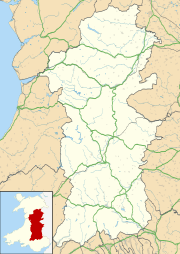
| Location | Near Llangynog, Wales |
|---|---|
| Coordinates | 52°49′58″N 3°24′7″W / 52.83278°N 3.40194°W |
| Altitude | 532 m (1,745 ft) |
| Type | Hillfort |
| History | |
| Periods | Bronze Age Iron Age |
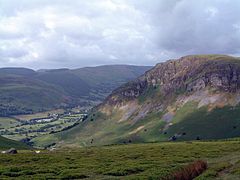
Craig Rhiwarth is a mountain in the Berwyn range in Powys, Wales. It looks over the village of Llangynog. At the very top of the mountain, you can find an ancient hillfort from the Iron Age. There are also old slate quarries on its southern slopes.
Contents
Exploring Craig Rhiwarth's Ancient Past
Craig Rhiwarth stands 532 meters (about 1,745 feet) high. The hillfort on its summit is one of the highest in all of Wales. It's a huge area, stretching about 850 meters (2,789 feet) from east to west. It is also about 400 to 500 meters (1,312 to 1,640 feet) wide.
What Was the Hillfort Like?
The hillfort has very steep slopes on almost all sides. This made it a natural fortress. On the north side, there is a broken stone wall. This wall sits above a steep bank. There are two ways to get into the hillfort. One is a simple opening in the middle of the wall. The other is a slanting entrance at the western end.
Homes of the Past
Inside the hillfort, you can see the remains of about 170 round stone buildings. These buildings were between 4 and 12 meters (13 to 39 feet) across. Experts believe people started living here in the late Bronze Age. They continued to live there into the Iron Age. The settlement was likely abandoned around the time the Romans arrived in the 1st century A.D.
You can also find a few rectangular stone structures. These are called hafodydd. They were probably used in the Middle Ages. People would live in them seasonally, perhaps when they moved their animals to higher pastures in summer.
The History of Slate Mining
On the southern slopes of Craig Rhiwarth, you can see the remains of old slate quarries. People have been quarrying slate here since at least 1705.
When Was the Quarry Busy?
The quarries were very active in the early 1800s. However, this activity slowed down later in that century. There was a new burst of work in the early 1900s. This happened when the Tanat Valley Light Railway opened. The railway made it easier to transport the slate. The quarries finally closed down between 1940 and 1941.
 | Selma Burke |
 | Pauline Powell Burns |
 | Frederick J. Brown |
 | Robert Blackburn |


