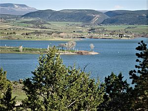
Crawford Dam facts for kids
Crawford Dam is a big earth wall that holds back water to create Crawford Reservoir in Delta County, Colorado. It's located about a mile south of the small town of Crawford.
This dam was finished in 1962 by the United States Bureau of Reclamation, which is a government agency that builds water projects. It's 162 feet tall (that's about as tall as a 16-story building!) and 580 feet long across the top. The dam helps control floods and provides water for farms in the area.
The dam is owned by the Bureau of Reclamation, but a local group called the Crawford Water Conservancy District helps manage it.
Crawford Reservoir: A Changing Lake
When Crawford Reservoir is completely full, its surface covers 406 acres. That's like 300 football fields! It also has about seven miles of shoreline, which is a lot of space to explore. The reservoir can hold a huge amount of water, about 14,395 acre-feet. An acre-foot is the amount of water needed to cover one acre of land with water one foot deep.
The main reason for the reservoir is to provide water for farming. Because of this, the water level changes a lot throughout the year. In late spring and early summer, the lake is usually full. But by early fall, the water level drops quite a bit, sometimes making it hard to launch boats. The water stays low through winter until spring, when melting snow and rain fill it up again.
Fun at Crawford State Park
Crawford Reservoir is part of Crawford State Park. The park's main office is on a small piece of land that sticks out into the lake.
There are lots of fun things to do at Crawford State Park! You can go fishing for different kinds of fish like yellow perch, northern pike, black crappie, largemouth bass, trout, and channel catfish. Boating is popular, and you can also go camping at one of the 66 campsites. Other activities include picnicking, swimming, and hiking around the beautiful park.
 | Charles R. Drew |
 | Benjamin Banneker |
 | Jane C. Wright |
 | Roger Arliner Young |


