Cruzville, New Mexico facts for kids
Quick facts for kids
Cruzville, New Mexico
|
|
|---|---|
| Country | United States |
| State | New Mexico |
| County | Catron |
| Area | |
| • Total | 2.55 sq mi (6.61 km2) |
| • Land | 2.55 sq mi (6.61 km2) |
| • Water | 0.00 sq mi (0.00 km2) |
| Elevation | 6,359 ft (1,938 m) |
| Population
(2020)
|
|
| • Total | 74 |
| • Density | 28.99/sq mi (11.19/km2) |
| Time zone | UTC-5 (Mountain (MST)) |
| • Summer (DST) | MDT |
| Area code(s) | 575 |
| GNIS feature ID | 2584084 |
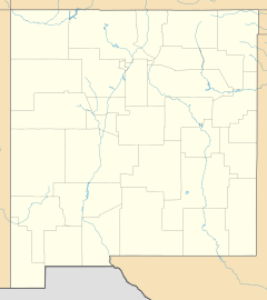
Cruzville is a small community in Catron County, New Mexico, in the United States. It is known as a census-designated place, which means it's a special area defined by the government for counting people. Cruzville is located about 9 miles (14 km) northeast of a town called Reserve.
This quiet community is nestled right inside the Apache National Forest. This means it's surrounded by lots of trees and nature. According to the 2010 census, 72 people lived there. By the 2020 census, the population had grown slightly to 74 people.
People Who Live in Cruzville
Just like schools count how many students they have, the government counts how many people live in different places. This count is called a census.
| Historical population | |||
|---|---|---|---|
| Census | Pop. | %± | |
| 2020 | 74 | — | |
| U.S. Decennial Census | |||
The latest count in 2020 showed that 74 people call Cruzville home. This number helps us understand how big the community is.
Schools and Learning
Students who live in Cruzville attend schools that are part of the Reserve Independent School District. This district provides education for children in the area.
See also
 In Spanish: Cruzville (Nuevo México) para niños


