Cummings, Kansas facts for kids
Quick facts for kids
Cummings, Kansas
|
|
|---|---|

|
|
| Country | United States |
| State | Kansas |
| County | Atchison |
| Elevation | 991 ft (302 m) |
| Time zone | UTC-6 (CST) |
| • Summer (DST) | UTC-5 (CDT) |
| ZIP code |
66016
|
| Area code | 913 |
| FIPS code | 20-16750 |
| GNIS ID | 478259 |
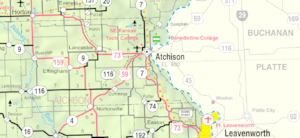
Cummings is a small, quiet place in Atchison County, Kansas, United States. It's known as an "unincorporated community." This means it's a group of homes and businesses that isn't officially a city or town with its own local government. Instead, it's part of the larger county. Cummings is located about 9.5 miles (15.3 kilometers) southwest of a bigger city called Atchison. Even though it's small, Cummings has its own post office with a special ZIP code, 66016.
A Look Back at Cummings
How Cummings Started
The community of Cummings was officially planned and laid out in 1883. This process is called "platting," which means someone drew up a map showing where streets, lots, and public areas would be. Before it was called Cummings, it was known as Cummingsville.
Who Named Cummings?
The community was named after its founder, a person named William Cummings. He was the one who helped establish the area and gave it its name.
 | Selma Burke |
 | Pauline Powell Burns |
 | Frederick J. Brown |
 | Robert Blackburn |

