Dale, Oklahoma facts for kids
Quick facts for kids
Dale
|
|
|---|---|
| Motto(s):
"Go Dale"
|
|
| Country | United States |
| State | Oklahoma |
| County | Pottawatomie |
| Area | |
| • Total | 0.74 sq mi (1.92 km2) |
| • Land | 0.74 sq mi (1.92 km2) |
| • Water | 0.00 sq mi (0.00 km2) |
| Elevation | 1,034 ft (315 m) |
| Population
(2020)
|
|
| • Total | 175 |
| • Density | 235.85/sq mi (91.08/km2) |
| Time zone | UTC-6 (Central (CST)) |
| • Summer (DST) | UTC-5 (CDT) |
| Area code(s) | 405/572 |
| FIPS code | 40-19150 |
| GNIS feature ID | 2629915 |
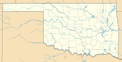
Dale is a small community in Pottawatomie County, Oklahoma, United States. It's known as an unincorporated community. This means it's not an official city or town, but it has a defined area for counting people. Dale is located along State Highway 270. It sits near the North Canadian River, a few miles northwest of the city of Shawnee. In 2020, about 175 people lived in Dale.
History of Dale
Dale was first planned out when the Rock Island railroad line was being built. This happened before Oklahoma became a state. The first post office in Dale opened on October 26, 1893.
The community was first called King. It was named after John King. He was an Absentee-Shawnee Indian. He owned the land where the community was started. In 1895, the name was changed to Dale. It was renamed in honor of Frank Dale. He was an important judge in Oklahoma Territory. He served as the Chief Justice of the Territorial Supreme Court from 1893 to 1898.
How Many People Live in Dale?
Dale is a small community. The number of people living there is counted every ten years. This count is called the U.S. Census.
| Historical population | |||
|---|---|---|---|
| Census | Pop. | %± | |
| 2020 | 175 | — | |
| U.S. Decennial Census | |||
In 2020, the census showed that 175 people lived in Dale. This was a small decrease from the 2010 census. Back then, 186 people lived in the community.
See also
 In Spanish: Dale (Oklahoma) para niños


