Damas District facts for kids
Quick facts for kids
Damas
|
|
|---|---|
|
District
|
|
| Country | |
| Province | San José |
| Canton | Desamparados |
| Creation | 8 October 1968 |
| Area | |
| • Total | 2.57 km2 (0.99 sq mi) |
| Elevation | 1,180 m (3,870 ft) |
| Population
(2011)
|
|
| • Total | 13,175 |
| • Density | 5,126/km2 (13,277/sq mi) |
| Time zone | UTC−06:00 |
| Postal code |
10310
|
Damas is a small area, or district, in Costa Rica. It is part of the Desamparados canton, which is located in the San José province.
Contents
History of Damas
Damas was officially created on 8 October 1968. Before this, it was part of another district called Patarrá. The creation of Damas as its own district was made possible by a special law, Ley 33.
Geography of Damas
Damas covers an area of about 2.57 square kilometers. To help you imagine this, it's roughly the size of 257 football fields! The district is located at an elevation of 1,180 meters above sea level. This means it's quite high up, offering cooler temperatures than coastal areas.
Population in Damas
| Historical population | |||
|---|---|---|---|
| Census | Pop. | %± | |
| 1973 | 4,376 | — | |
| 1984 | 7,351 | 68.0% | |
| 2000 | 12,993 | 76.8% | |
| 2011 | 13,175 | 1.4% | |
|
Instituto Nacional de Estadística y Censos |
|||
According to the 2011 census in Costa Rica, Damas had a population of 13,175 people. This number shows how the population has grown over the years. For example, in 1973, there were only 4,376 people living there.
Getting Around Damas
Road Connections
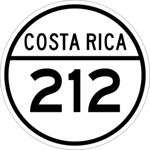
The district of Damas is connected by important roads. One of the main roads that goes through Damas is:
- National Route 212
This road helps people travel in and out of Damas, connecting it to other parts of the region.
See also
 In Spanish: Damas (Costa Rica) para niños
 | Selma Burke |
 | Pauline Powell Burns |
 | Frederick J. Brown |
 | Robert Blackburn |


