Dapa, Valle del Cauca facts for kids
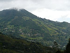
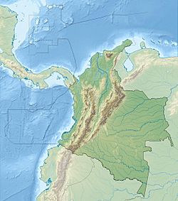
Dapa is a lovely small village in the mountains of west central Colombia. Many people have weekend homes here. It's about 15 kilometers (9 miles) northwest of the big city of Cali. Dapa is part of the Yumbo Municipality in the Valle del Cauca Department.
Quick facts for kids
Dapa
|
|
|---|---|
|
Town
|
|

Rincón Dapa Sector and the Antenna Mountain
|
|
| Country | |
| Department | Valle del Cauca |
| Elevation | 1,800 m (5,900 ft) |
Contents
Exploring Dapa's Geography and Roads
Dapa is located on the eastern side of the West Andes mountains. These mountains are above the Cauca River Valley. The land here goes from 1,200 m (3,900 ft) high in the lower hills to 2,100 m (6,900 ft) on the highest ridges.
The lowest part of Dapa is called Pilas de Dapa. This is where the main road crosses the Arroyohondo River and starts climbing the mountain. Most people live higher up, above 1,500 m (4,900 ft). This area is split into different sections:
- Medio Dapa: This part is about halfway up the mountain. You'll find many homes and farms here.
- Miravalle: This is the main center where more people live. It has a police station, a school, and several shops. There are also many homes and a church.
- Rincón Dapa: This area is further up the mountain. It sits in a natural bowl shape formed by several streams. These streams join to create the Arroyohondo River. Here you'll see large estates, farms, homes, a school, and small businesses like stores and restaurants.
- Alto Dapa: Located above Miravalle, this area mainly has large estates and farms.
How to Get to Dapa
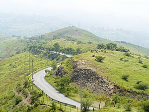
The main road to Dapa is called Carretera Dapa. It's a paved road, but its condition can be a bit rough. This road starts from the Cali-Yumbo road. It winds through the lower part of Arroyohondo before climbing up the mountain into Dapa. As you drive up, you'll pass through huge open areas with dry plants. You'll also get amazing views of the Arroyohondo River canyon and the Cauca Valley.
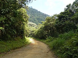
Many unpaved roads branch off from Dapa. These roads lead to other rural places.
- To the west, the Dapa-Chicoral road goes through the Cerro Dapa Carisucio Forest Reserve. It crosses a pass at 2,100 m (6,900 ft). Then it drops down into the Hindú tea plantation and the area of Chicoral. This road continues towards La Cumbre.
- To the south, there are two roads. One goes towards La Paz and eventually reaches the western edge of Cali. The other leads towards Kilometer 18 on the Cali-Buenaventura Road.
- To the north and east, there is a road that goes towards Yumbo.
Dapa's Climate and Nature
Dapa has a climate that changes from tropical to subtropical. This means you can find many different types of natural areas here.
- In the lower parts, there are patches of dry forests and dry grasslands with scattered trees. You can also find woodlands along rivers and many gardens.
- In the upper parts, there are patches of humid forests, shrublands, and bushy pastures. There are also gardens, farms, and even cloud forests.
Dapa is located within the Arroyohondo watershed. This is an area where all the water drains into the Cauca River, north of Cali. The natural habitats in Dapa have unfortunately been damaged and broken up. However, they are still important examples of the Cauca Valley Dry Forest Ecoregion in the lower areas. In the higher parts, they represent the Cauca Valley Montane Forest Ecoregion.
High up on the ridges above Dapa, you'll find the Dapa Carisucio Forest Reserve. This is a special protected area.
A Brief History of Dapa
Dapa was officially formed in the year 1958.
Fun Things to Do in Dapa
Dapa offers many exciting outdoor activities. Some of the most popular things to do include:
- Hiking
- Birdwatching
- Mountain biking
- Horseback riding
- Off-road vehicle use
See also
 In Spanish: Dapa para niños
 | Kyle Baker |
 | Joseph Yoakum |
 | Laura Wheeler Waring |
 | Henry Ossawa Tanner |


