Derby, Ohio facts for kids
Quick facts for kids
Derby, Ohio
|
|
|---|---|

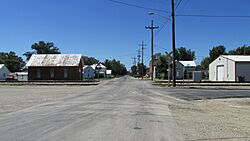
Looking northwest on London Road in Derby, Ohio
|
|

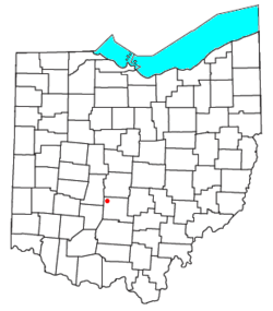
Location of Derby, Ohio
|
|
| Country | United States |
| State | Ohio |
| County | Pickaway |
| Township | Darby |
| Elevation | 909 ft (277 m) |
| Population
(2020)
|
|
| • Total | 355 |
| Time zone | UTC-5 (Eastern (EST)) |
| • Summer (DST) | UTC-4 (EDT) |
| ZIP |
43117
|
| GNIS feature ID | 2628883 |
Derby is a small community located in the state of Ohio, in the United States. It is a special kind of place called a census-designated place, or CDP. This means it's an area that the government counts for population, but it's not officially a city or town with its own local government.
Derby is found in the central part of Darby Township, which is in Pickaway County. In the year 2020, about 355 people lived in Derby. The area uses the ZIP code 43117.
A Glimpse into Derby's History
Derby began to grow when a railroad line was built and extended to this location. The arrival of the railroad often brought more people and businesses to an area. A post office was officially opened in Derby in 1881. This was an important step for the community, making it easier for people to send and receive mail.
Discover More About Derby
 In Spanish: Derby (Ohio) para niños
 | Lonnie Johnson |
 | Granville Woods |
 | Lewis Howard Latimer |
 | James West |

