Dewar, Iowa facts for kids
Quick facts for kids
Dewar, Iowa
|
|
|---|---|
| Country | United States |
| State | Iowa |
| County | Black Hawk |
| Elevation | 889 ft (271 m) |
| Time zone | UTC-6 (Central (CST)) |
| • Summer (DST) | UTC-5 (CDT) |
| ZIP codes |
50623
|
| Area code(s) | 319 |
| GNIS feature ID | 455900 |
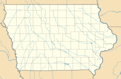
Dewar is a small place in eastern Black Hawk County, Iowa, United States. It's known as an unincorporated town. This means it doesn't have its own local government like a city does.
Dewar is located northeast of Waterloo. Waterloo is the main city and the county seat for Black Hawk County. Dewar sits about 889 feet (271 meters) above sea level. Even though it's unincorporated, Dewar has its own post office. This post office uses the ZIP code 50623 and first opened way back on October 25, 1887.
A Look Back at Dewar's History
Dewar was first planned out in 1888. This process is called being "platted." Before it was called Dewar, it was known as Emert.
Over the years, Dewar's population has changed. In 1902, only 22 people lived there. By 1925, the number grew to 40 people. The population continued to increase, reaching 84 residents by 1940.
 | Delilah Pierce |
 | Gordon Parks |
 | Augusta Savage |
 | Charles Ethan Porter |


