Djambala facts for kids
Quick facts for kids
Djambala
|
|
|---|---|
| Country | |
| Department | Plateaux Department |
| District | Djambala District |
| Commune | Djambala |
| Elevation | 622 m (2,041 ft) |
| Population
(2018)
|
|
| • Total | 14,989 |
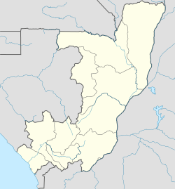
Djambala is a town in the Republic of the Congo. It is an important administrative center. Djambala is the main town for both the Djambala District and the Plateaux Department.
You can find Djambala north of Brazzaville, which is the capital city. It is also close to the Léfini Faunal Reserve, a protected area for animals.
Contents
What is Djambala Like?
Djambala is a town where about 15,000 people live. It is located in the central part of the Republic of the Congo. The town sits at an elevation of 622 meters (about 2,041 feet) above sea level.
Weather in Djambala
Djambala has a tropical climate. This means it is warm and humid for most of the year. The town experiences two main seasons: a long wet season and a short dry season.
Wet Season
The wet season lasts for about nine months, from September to May. During these months, Djambala gets a lot of rain. The air is very humid, and temperatures are warm.
Dry Season
The dry season is shorter, lasting from June to August. Even though it's called the dry season, it can still be warm and humid. There is less rain during these months.
| Climate data for Djambala (1951-1960, extremes 1941-present) | |||||||||||||
|---|---|---|---|---|---|---|---|---|---|---|---|---|---|
| Month | Jan | Feb | Mar | Apr | May | Jun | Jul | Aug | Sep | Oct | Nov | Dec | Year |
| Record high °C (°F) | 31.5 (88.7) |
32.7 (90.9) |
34.0 (93.2) |
35.0 (95.0) |
39.6 (103.3) |
30.8 (87.4) |
37.2 (99.0) |
35.4 (95.7) |
33.6 (92.5) |
35.0 (95.0) |
37.1 (98.8) |
31.5 (88.7) |
39.6 (103.3) |
| Mean daily maximum °C (°F) | 27.6 (81.7) |
27.8 (82.0) |
28.4 (83.1) |
28.5 (83.3) |
27.6 (81.7) |
26.9 (80.4) |
26.2 (79.2) |
27.0 (80.6) |
27.0 (80.6) |
26.6 (79.9) |
27.1 (80.8) |
27.1 (80.8) |
27.3 (81.1) |
| Daily mean °C (°F) | 23.2 (73.8) |
23.5 (74.3) |
23.7 (74.7) |
23.8 (74.8) |
23.6 (74.5) |
22.5 (72.5) |
21.7 (71.1) |
22.1 (71.8) |
22.5 (72.5) |
22.8 (73.0) |
22.7 (72.9) |
22.9 (73.2) |
22.9 (73.2) |
| Mean daily minimum °C (°F) | 19.2 (66.6) |
19.2 (66.6) |
19.3 (66.7) |
19.6 (67.3) |
19.5 (67.1) |
17.9 (64.2) |
16.8 (62.2) |
17.0 (62.6) |
18.3 (64.9) |
18.9 (66.0) |
19.0 (66.2) |
19.1 (66.4) |
18.6 (65.5) |
| Record low °C (°F) | 15.0 (59.0) |
12.8 (55.0) |
14.9 (58.8) |
16.0 (60.8) |
15.3 (59.5) |
12.5 (54.5) |
12.1 (53.8) |
12.6 (54.7) |
15.1 (59.2) |
15.4 (59.7) |
14.0 (57.2) |
12.8 (55.0) |
12.1 (53.8) |
| Average precipitation mm (inches) | 127.4 (5.02) |
152.5 (6.00) |
172.3 (6.78) |
166.3 (6.55) |
144.4 (5.69) |
60.0 (2.36) |
30.2 (1.19) |
43.7 (1.72) |
136.5 (5.37) |
233.1 (9.18) |
193.9 (7.63) |
166.6 (6.56) |
1,626.9 (64.05) |
| Average precipitation days (≥ 0.1 mm) | 17 | 15 | 19 | 19 | 15 | 3 | 1 | 4 | 11 | 20 | 21 | 19 | 164 |
| Average relative humidity (%) | 80 | 83 | 83 | 83 | 84 | 82 | 80 | 76 | 80 | 85 | 86 | 86 | 82 |
| Mean monthly sunshine hours | 151.9 | 146.9 | 158.1 | 156.0 | 167.4 | 168.0 | 158.1 | 151.9 | 129.0 | 130.2 | 129.0 | 139.5 | 1,786 |
| Percent possible sunshine | 40 | 43 | 42 | 44 | 45 | 47 | 43 | 41 | 36 | 35 | 35 | 37 | 41 |
| Source 1: NOAA (mean temperature, precipitation 1991-2020), Deutscher Wetterdienst (precipitation days 1950-1970, humidity 1952-1967, and sunshine 1965-1990) | |||||||||||||
| Source 2: Meteo Climat (extremes) | |||||||||||||
Getting Around Djambala
Djambala has ways for people and goods to travel.
Railway Plans
In 2007, a plan was made to build a railway line. This railway would connect Djambala to the main port. It would mainly be used to transport timber (wood) from the area.
Djambala Airport
The town also has its own airport, called Djambala Airport. This allows people to travel to and from Djambala by air.
See also

- In Spanish: Djambala para niños
 | William L. Dawson |
 | W. E. B. Du Bois |
 | Harry Belafonte |


