Dobroyd Head facts for kids
Dobroyd Head is a cool spot of land sticking out into the water. It's found in the Northern Beaches area of Balgowlah Heights, New South Wales, Australia. This headland is part of the Sydney Harbour National Park. This park helps protect important natural areas, like coastal heath, which are special types of plant communities. Nearby is Tania Park, which has a radio transmitter. There's also a lookout named after Arabanoo. He was an Aboriginal man who lived with European settlers after being captured in 1788.
History of Dobroyd Head
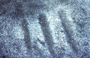
Long ago, in 1788, Captain Arthur Phillip saw Aboriginal people living in caves here. Today, we still find signs of their ancient camps. These include grinding grooves, where they sharpened tools or prepared food. There are also shell middens (old rubbish heaps) at places like Reef Beach.
The name 'Dobroyd' comes from Simeon Lord, an early landowner in the 1800s. He named it after Dobroyd Castle, his mother's home in England. When he passed away in 1840, he gave the land to the government. He asked them to keep the name.
Later, in 1871, a government official named Bowie Wilson set aside about 100 hectares of Dobroyd Head. This area was meant to be a defence reserve. This meant it was kept for military purposes, but private lands like beaches were not included.
A sad event happened in 1874. A famous surveyor named John Thomas Ewing Gowlland drowned near the headland. Years later, in 1963, a plaque was put up to remember him. In 1914, a government boat called the SS Kate sank off the headland. It was hit by the Manly ferry Bellubera. The Dobroyd Scenic Drive, a road for cars, was opened in 1938. Percy Nolan, the mayor of Manly, helped open it.
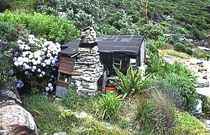
Between 1923 and 1963, small cabins and shacks were built around Crater Cove. People used these as weekend getaways. They were lived in until the 1980s.
For many years, there were plans to build houses on Dobroyd Head. But in the late 1950s, Manly Council wanted to protect the land. An alderman (a local council member) named Frank Preacher led this effort. In 1960, the Lands Minister, Jack Renshaw, visited the area. He agreed to stop the sale of the land. He then gave Manly Council the job of protecting it.
In 1975, the area became part of the Sydney Harbour National Park. This means it is now protected for everyone to enjoy. An article in 2015 mentioned that Manly Council had voted to put up a plaque. This plaque would honour Renshaw, Preacher, and the council for saving the headland. However, this plaque has not been put up yet.
 | Bayard Rustin |
 | Jeannette Carter |
 | Jeremiah A. Brown |


