Dogwood Acres, Alamance County, North Carolina facts for kids
Quick facts for kids
Dogwood Acres
|
|
|---|---|
| Country | United States |
| State | North Carolina |
| County | Alamance |
| Elevation | 653 ft (199 m) |
| Time zone | UTC-5 (Eastern (EST)) |
| • Summer (DST) | UTC-4 (EDT) |
| GNIS feature ID | 1003470 |
Dogwood Acres is a small place in North Carolina, USA. It is known as an unincorporated community. This means it's a group of homes and people living together, but it doesn't have its own local government like a city or town does.
Contents
Discovering Dogwood Acres
Dogwood Acres is located in Alamance County. This county is part of the state of North Carolina, which is in the United States. It's a quiet spot that sits at an elevation of 653 feet (about 199 meters) above sea level.
Where is Dogwood Acres?
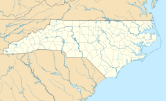
Imagine looking at a map of the United States. You would first find the state of North Carolina on the East Coast. Then, within North Carolina, you would look for Alamance County. Dogwood Acres is found right there, in Alamance County. Its exact spot on the map is 36 degrees, 4 minutes, and 3 seconds North, and 79 degrees, 27 minutes, and 41 seconds West.
What is an Unincorporated Community?
An unincorporated community is a place where people live close together, but it's not officially a city or town. This means it doesn't have its own mayor or city council. Instead, the county government, like Alamance County, takes care of things like roads, police, and other services for Dogwood Acres. It's a way for people to live in a community without all the rules and taxes that come with being an official city.
Understanding Elevation
When we say Dogwood Acres is at an elevation of 653 feet, it means how high up it is from the ocean's surface. Think of it like being on a hill or a plateau. The higher the elevation, the further you are from sea level. This measurement helps us understand the geography of the area.
 | Chris Smalls |
 | Fred Hampton |
 | Ralph Abernathy |


