Eagle, Pennsylvania facts for kids
Quick facts for kids
Eagle, Pennsylvania
|
|
|---|---|

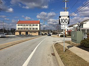
Intersection of Pottstown Pike and Little Conestoga Road in Eagle
|
|

Location of Eagle in Chester County, Pennsylvania (top) and of Chester County in Pennsylvania (below)
|
|
| Country | United States |
| State | Pennsylvania |
| County | Chester |
| Township | Upper Uwchlan |
| Elevation | 256 ft (78 m) |
| Population
(2020)
|
|
| • Total | 498 |
| Time zone | UTC-5 (EST) |
| • Summer (DST) | UTC-4 (EDT) |
| Area code(s) | 610 |
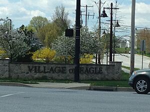
Eagle is a small community located in Upper Uwchlan Township, Chester County, Pennsylvania, in the United States. It is also known as "Uwchland," "Windsor," or the "Village of Eagle." It is an unincorporated community and a census-designated place, which means it's a special area identified by the government for counting people.
What is Eagle, Pennsylvania?
Eagle is a community where people live and work. In 2020, about 498 people lived there. Even though it's a smaller place, it has its own unique character and history.
Where is Eagle Located?
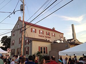
The center of Eagle is found at the intersection of two roads: Pottstown Pike (Pennsylvania Route 100) and Little Conestoga Road. This spot is special because it's where the old Eagle Tavern is located. Eagle is positioned at coordinates 40°4′40″N 75°41′16″W.
Growth and Changes in Eagle
In recent years, the areas around Eagle have seen a lot of new buildings and homes. To help with the increased traffic from this growth, a new road was built in the early 2000s. This new road, called a bypass, helps cars get around without going through the very center of the village. This was important to keep traffic flowing and to protect historic buildings like the Eagle Tavern.
 | Jewel Prestage |
 | Ella Baker |
 | Fannie Lou Hamer |


