
Earth observation satellite facts for kids
An Earth observation satellite is like a special eye in space. These satellites orbit our planet to collect information about it. They help us understand Earth's weather, environment, and even create detailed maps. Some satellites take amazing pictures, while others use different tools to gather data.
The first step into satellite observation happened on October 4, 1957. The Soviet Union launched Sputnik 1. It sent radio signals that helped scientists study Earth's upper atmosphere. Soon after, on January 31, 1958, the United States launched Explorer 1. This satellite discovered important radiation belts around Earth. Then, on April 1, 1960, TIROS-1 sent back the very first TV pictures of weather from space.
By 2008, over 150 Earth observation satellites were in orbit. They collected huge amounts of data every day. By 2021, this number grew to more than 950 satellites. Many of these are operated by a company called Planet Labs.
Contents
How Satellites Orbit Earth
Most Earth observation satellites fly quite close to our planet. They usually orbit at heights between 500 to 800 kilometers (about 310 to 500 miles). Flying lower helps them get very clear and detailed information. However, they need occasional boosts to stay in orbit because of tiny amounts of air drag.
The European Space Agency has satellites like ERS-1, ERS-2, and Envisat. These fly at about 800 kilometers (500 miles) high. Other European satellites, like Proba-1, Proba-2, and SMOS, orbit at around 700 kilometers (435 miles). The UAE's DubaiSat-1 and DubaiSat-2 also fly in these lower orbits. They provide images of different parts of Earth.
Different Types of Orbits
To see the whole Earth, many satellites use a polar orbit. This means they fly over the North and South Poles. As the satellite circles Earth, our planet rotates below it. This allows the satellite to scan a different part of the globe with each pass. Most of these satellites are in a Sun-synchronous orbit. This special path means they pass over the same spot on Earth at the same time each day. This makes it easier to compare images taken at different times.
Another type is a geostationary orbit. These satellites are much higher, at about 36,000 kilometers (22,000 miles). At this height, a satellite takes exactly 24 hours to orbit Earth. This means it stays above the same spot on the ground all the time. Three geostationary satellites can cover almost the entire Earth. This orbit is mostly used for weather satellites because they need to watch the same area continuously.
A Look Back: History of Earth Observation
_seen_by_the_American_reconnaissance_satellite_Corona_98_(KH-4A_1023)_(1965-08-23).png)
The idea of using spacecraft to observe Earth goes back many years. In 1928, a scientist named Herman Potočnik wrote a book about space travel. He imagined how special conditions in space could be useful. He even described satellites that could stay in one spot, like today's geostationary satellites.
Later, during the Cold War, countries wanted to gather information about each other. This led to fast progress in launching satellites and camera technology. Satellites became a safer way to observe from above. After 1960, satellites like CORONA largely replaced spy planes for gathering information.
What Earth Observation Satellites Do
Earth observation satellites have many important jobs. They help us understand our planet better and protect it.
Watching the Weather

Weather satellites are designed to keep an eye on Earth's weather and climate. They don't just see clouds and storms. They can also spot city lights, wildfires, and even pollution. These satellites track things like aurora lights, dust storms, and snow cover. They also help map ice and ocean currents.
For example, weather satellite images helped monitor the ash cloud from Mount St. Helens when it erupted. They also tracked smoke from large fires in places like Colorado and Utah. This information helps people prepare and stay safe.
Monitoring Our Environment

Other environmental satellites help us watch for changes on Earth. They can detect shifts in plant life, track gases in the atmosphere, and monitor the state of our oceans and ice fields. By watching how plants change over time, scientists can spot droughts. They can compare current plant growth to what is normal for that area.
These satellites also help track events like oil spills. For instance, the European ENVISAT satellite watched an oil spill off the coast of Spain. Even though it wasn't a weather satellite, its special tools could see changes on the ocean surface. Satellites can also help monitor air pollution by tracking gases like NO2 and SO2.
Creating Maps of Earth
Satellites are also excellent for mapping Earth's terrain. Satellites like Radarsat-1 and TerraSAR-X use special radar technology. This allows them to create detailed maps of the ground, even through clouds or at night.
See also
- First images of Earth from space
- Space telescope
- Satellite altimetry
Images for kids
-
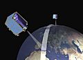
RapidEye satellites working together to observe Earth.

