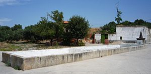
El Gordo, Cáceres facts for kids
Quick facts for kids
El Gordo, Cáceres
|
|||
|---|---|---|---|
|
|||
| Country | Spain | ||
| Autonomous community | Cáceres | ||
| Area | |||
| • Total | 78.72 km2 (30.39 sq mi) | ||
| Elevation | 321 m (1,053 ft) | ||
| Population
(2018)
|
|||
| • Total | 363 | ||
| • Density | 4.611/km2 (11.943/sq mi) | ||
| Time zone | UTC+1 (CET) | ||
| • Summer (DST) | UTC+2 (CEST) | ||
El Gordo is a small town, also known as a municipality, located in Spain. It is part of the Province of Cáceres, which is in the Extremadura region. This area is known for its beautiful natural landscapes.
Contents
Where is El Gordo Located?
El Gordo is found in the western part of Spain. It is in the Province of Cáceres, which is one of the two provinces in the Extremadura autonomous community. An autonomous community is like a large region with its own government.
The town is situated about 321 meters (or 1,053 feet) above sea level. This means it's a bit higher up than places at the coast.
How Many People Live in El Gordo?
As of 2018, about 363 people live in El Gordo. This makes it a very small and quiet community. The municipality covers an area of about 78.72 square kilometers (or 30.39 square miles). To give you an idea, this is roughly the size of a medium-sized city park, but with much more open space.
What is a Municipality?
In Spain, a municipality is a local government area. It's like a town or a small city with its own local council. This council helps manage things like local services and public spaces for the people living there. El Gordo is one such municipality.
Symbols of El Gordo
Like many towns, El Gordo has its own special symbols. These include a flag and a shield (or coat of arms). These symbols often show important parts of the town's history or what the area is known for. You can see the flag and shield in the information box at the top of this page.
See Also
- For more information about El Gordo (Cáceres) for kids, check out the article in Spanish: El Gordo (Cáceres) para niños
 | Claudette Colvin |
 | Myrlie Evers-Williams |
 | Alberta Odell Jones |


