Enning, South Dakota facts for kids
Quick facts for kids
Enning
|
|
|---|---|
| Country | United States |
| State | South Dakota |
| County | Meade |
| Time zone | UTC-7 (Mountain (MST)) |
| • Summer (DST) | UTC-6 (MDT) |
| ZIP codes |
57737
|
| Area code(s) | 605 |
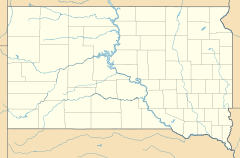
Enning is a small, unincorporated community located in Meade County, South Dakota, in the United States. An "unincorporated community" means it's a group of homes and buildings that isn't officially a town or city with its own local government. Enning sits at an elevation of about 925 meters (3,035 feet) above sea level. It was named after Anna Enning, who donated land for a school there. Even though it's not tracked by the Census Bureau like bigger towns, Enning has its own ZIP code, which is 57737.
Enning's Early Days
The very first settlement in the area that became Enning was established in 1910. This was when people started to build homes and create a community there.
Where is Enning Located?
Enning is found in the western part of South Dakota. It's specifically within Meade County. The community is situated in a landscape that is about 925 meters (3,035 feet) above sea level. This elevation means it's quite high up compared to sea level.
 | Laphonza Butler |
 | Daisy Bates |
 | Elizabeth Piper Ensley |


