Eynsham Lock facts for kids
 |
|
| Waterway | River Thames |
|---|---|
| County | Oxfordshire |
| Maintained by | Environment Agency |
| Operation | Manual |
| First built | 1928 |
| Length | 34.51 m (113 ft 3 in) |
| Width | 4.97 m (16 ft 4 in) |
| Fall | 0.84 m (2 ft 9 in) |
| Above sea level | 195' |
| Distance to Teddington Lock |
100 miles |
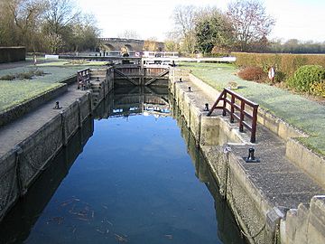
Eynsham Lock is a special kind of gate system on the River Thames in England. It helps boats move up and down the river when the water level changes. This lock is located on the southern side of the river, close to a village called Swinford in Oxfordshire. The larger village of Eynsham is a short distance away on the northern bank.
Eynsham Lock was one of the very last "pound locks" built on the Thames. It was constructed in 1928 by the Thames Conservancy, a group that managed the river at the time. A "weir," which is like a small dam that controls water flow, is located on the other side of an island, following the river's original path.
Discovering Eynsham Lock's Past
Before the current lock, there was an older system called a "flash lock" and a weir. This was known as Eynsham or Bolde's weir. It was first owned by Eynsham Abbey, a historic monastery.
The weir was rebuilt in 1886 to help manage the river's flow. Around 1890, a special slide was added. This "boatslide" helped small boats get past the weir by sliding them over it.
The modern "pound lock" was built in 1928. It was created by cutting a new channel across a bend in the river. This made it much easier for boats to travel. The weir itself was also rebuilt again in 1950.
How to Visit Eynsham Lock
Eynsham Lock is easy to find! It's located very close to the B4044 road. This road crosses the river at a place called Swinford Toll Bridge.
You can reach the lock easily on foot. There's a special path that lets you walk across both the lock and the weir. It's a great spot to see the river up close.
Exploring the River Above the Lock
Just a short distance upstream from Eynsham Lock, you'll find the Swinford Toll Bridge. In the past, there was a very sharp, horseshoe-shaped bend in the river after this bridge. This bend made it tricky for boats to navigate.
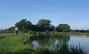
To solve this problem, a new channel was dug in 1900. This "cut" straightened out the river, making it much safer and easier for boats to pass. As you continue upstream, the river flows southwest through mostly open countryside. The only major stop along this part of the river is a large marina on the eastern bank, where many boats are docked.
For those who love walking, the Thames Path follows the southern bank of the river. You can walk along this path all the way from Eynsham Lock to Pinkhill Lock.
 | George Robert Carruthers |
 | Patricia Bath |
 | Jan Ernst Matzeliger |
 | Alexander Miles |


