Fatfield Woods facts for kids
Quick facts for kids Fatfield Woods |
|
|---|---|
| Geography | |
| Location | Tyne and Wear, England |
| OS grid | NZ305543 |
| Coordinates | 54°52′55″N 1°31′30″W / 54.882°N 1.525°W |
| Area | 8.99 hectares (22.21 acres) |
Fatfield Woods is a lovely woodland area located in Tyne and Wear, England. It is close to the town of Washington. This woodland covers a total area of about 8.99 hectares, which is roughly the size of 17 football fields! It's a special place for both nature and people.
Contents
What is Fatfield Woods?
Fatfield Woods is a natural area filled with many trees. It's a type of forest, but often "woodland" is used for smaller forests. These areas are important for the environment. They help keep our air clean and provide homes for many animals.
Where is Fatfield Woods Located?
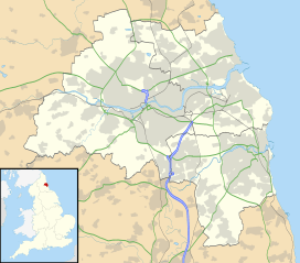
You can find Fatfield Woods in the county of Tyne and Wear. This is in the north-east part of England. Its location near Washington makes it easy for local people to visit. It's a green space in an area with towns and cities.
Who Looks After Fatfield Woods?
Fatfield Woods is owned and cared for by the Woodland Trust. This is a charity in the United Kingdom. Their main goal is to protect and plant trees and woodlands. They work hard to make sure places like Fatfield Woods stay healthy. They also make sure people can enjoy these natural spaces.
Why are Woodlands Important?
Woodlands like Fatfield Woods are super important for many reasons. They are like the lungs of our planet. Trees take in carbon dioxide, a gas that can harm the environment. They then release oxygen, which we need to breathe.
Home for Wildlife
Woodlands are bustling homes for all sorts of wildlife. Many different plants grow there, from tall trees to small flowers. These plants provide food and shelter for animals. You might find birds nesting in the trees. Small mammals like squirrels and foxes also live there. Insects play a vital role too, helping plants grow.
A Place for People
Fatfield Woods is not just for animals; it's for people too! It's a great place to go for a walk or a run. Many people enjoy spending time in nature. It helps them relax and feel good. Woodlands offer a quiet escape from busy town life. They are perfect for exploring and learning about nature.
Protecting Our Woodlands
It's very important to protect woodlands like Fatfield Woods. They face challenges like pollution and climate change. The Woodland Trust helps by managing the woods carefully. They plant new trees and look after the existing ones. Everyone can help by being respectful when visiting. Remember to take your litter home and stick to paths. This helps keep the woodland healthy for everyone.
 | Aurelia Browder |
 | Nannie Helen Burroughs |
 | Michelle Alexander |


