Rosreestr facts for kids
| Федеральная служба государственной регистрации, кадастра и картографии | |

Agency seal
|
|

Agency flag
|
|
 |
|
| Agency overview | |
|---|---|
| Formed | 9 March 2004 |
| Preceding agencies |
|
| Jurisdiction | Government of Russia |
| Headquarters | Chistoprudny Boulevard 6/19, Moscow |
| Minister responsible |
|
| Website |
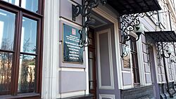
Building details
|

Headquarters of the agency in Moscow
|
|
The Federal Service for State Registration, Cadastre and Cartography, often called Rosreestr, is a special government agency in Russia. It helps manage important information about land and property. Think of it as the official record-keeper for all things related to real estate and maps in Russia.
Before December 30, 2008, this agency was known as the Federal Registration Service. Its shorter name, Rosreestr, became official on March 2, 2009.
Contents
What Rosreestr Does
Rosreestr has several key jobs that are very important for Russia. It makes sure that all land and property records are correct and easy to find. This helps people know who owns what.
Managing Property Records
One of Rosreestr's main tasks is to keep the Unified State Register of Rights on Real Estate and Transactions. This is a big database that lists who owns land, houses, and other buildings. It also records when properties are bought, sold, or rented. This system helps prevent arguments about who owns a property. It makes sure that property deals are legal and clear for everyone.
Creating Maps and Spatial Data
Rosreestr is also in charge of all official maps of Russia. This includes creating and updating detailed maps of the country. They manage something called the spatial data infrastructure. This means they collect, store, and share information about locations and geographical features. This data is used for many things, like planning new roads or understanding where natural resources are.
Official Cadastre and Cartography
The agency is Russia's official cadastre and cartography agency.
- Cadastre means keeping a public record of the value, ownership, and boundaries of land. It's like a detailed inventory of all land parcels.
- Cartography is the science and art of making maps. Rosreestr ensures that Russia's maps are accurate and up-to-date.
How Rosreestr Was Formed
Rosreestr was created on March 9, 2004. It was formed by combining the work of a few older agencies. These included the Federal Agency for Geodesy and Cartography (Roskartografiya) and the Federal Real Estate Cadastre Agency (Rosnedvizhimost). Bringing these agencies together helped to make the process of managing land and maps more organized and efficient.
Where Rosreestr is Located
The main office, or headquarters, of Rosreestr is in Moscow, Russia. You can find it at Chistoprudny Boulevard 6/19. This central location helps the agency manage its important work across the entire country.
See also
- Corps of Military Topographers of the Russian Imperial Army
 | James Van Der Zee |
 | Alma Thomas |
 | Ellis Wilson |
 | Margaret Taylor-Burroughs |

