Fifth Ward, Louisiana facts for kids
Quick facts for kids
Fifth Ward, Louisiana
|
|
|---|---|
| Country | United States |
| State | Louisiana |
| Parishes | Avoyelles |
| Area | |
| • Total | 5.20 sq mi (13.47 km2) |
| • Land | 5.20 sq mi (13.47 km2) |
| • Water | 0.00 sq mi (0.00 km2) |
| Elevation | 72 ft (22 m) |
| Population
(2020)
|
|
| • Total | 921 |
| • Density | 177.12/sq mi (68.38/km2) |
| Time zone | UTC-6 (Central (CST)) |
| • Summer (DST) | UTC-5 (CST) |
| ZIP code |
71351
|
| FIPS code | 22-25545 |
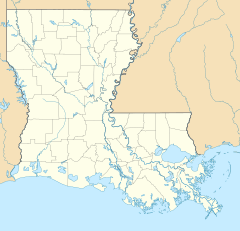
Fifth Ward is a small community in Avoyelles Parish, Louisiana, in the United States. It's called an unincorporated community because it doesn't have its own local government like a city or town. It's also a census-designated place, which means the U.S. Census Bureau counts it as a specific area for gathering population information.
In 2010, about 800 people lived in Fifth Ward. By 2020, the population had grown to 921 people.
Fifth Ward is located along Louisiana Highway 1. It is about 7 miles (11 km) west of Marksville, which is the main town of Avoyelles Parish. It's also about 23 miles (37 km) southeast of Alexandria, a larger city.
About the People of Fifth Ward
| Historical population | |||
|---|---|---|---|
| Census | Pop. | %± | |
| 2020 | 921 | — | |
| U.S. Decennial Census | |||
This section, called demographics, tells us about the people who live in Fifth Ward. It includes information like how many people live there and how the population has changed over time.
- In 2010, the population was 800.
- By 2020, the population had increased to 921 people.
Education in Fifth Ward
The public schools in Fifth Ward are managed by the Avoyelles Parish School Board. This board is responsible for making sure students in the area get a good education.
See also

- In Spanish: Fifth Ward (Luisiana) para niños
 | May Edward Chinn |
 | Rebecca Cole |
 | Alexa Canady |
 | Dorothy Lavinia Brown |


