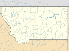
Flatwillow, Montana facts for kids
Quick facts for kids
Flatwillow
|
|
|---|---|
| Country | United States |
| State | Montana |
| County | Petroleum |
| Elevation | 3,225 ft (983 m) |
| Time zone | UTC-7 (Mountain (MST)) |
| • Summer (DST) | UTC-6 (MDT) |
| GNIS feature ID | 771461 |
Flatwillow (also called Flatwillow Crossing) was once a small town in southern Petroleum County, Montana, United States. Today, all the buildings are gone. The land where the town used to be is now private farmland.
Contents
Flatwillow's Past
Flatwillow was located along local roads. It was south of the town of Winnett. Winnett is the main town, or county seat, of Petroleum County. Flatwillow was about 3,225 feet (983 meters) above sea level.
The town had a post office for many years. It first opened on March 27, 1883. Then it closed on April 15, 1907. But it didn't stay closed for long! It reopened on August 1, 1908. The post office finally closed for good on April 30, 1946.
Flatwillow's Weather
Flatwillow has a cold semi-arid climate. This means it's often dry. It also has cold winters.
Winter Weather
Winters in Flatwillow are cold and dry. The weather can change a lot. It might be extremely cold one day. Then it could be much milder the next. The average lowest temperature each year is -26 degrees Fahrenheit. Temperatures often drop below 0 degrees Fahrenheit about 20 days a year. High temperatures stay below 0 degrees Fahrenheit only about 2 days a year.
Spring and Summer
Spring arrives quickly in March. But it can still snow as late as May! This is the wettest time of year. There are often showers and thunderstorms. Summer is hot and dry. But the nights are usually cool and pleasant. The temperature goes above 90 degrees Fahrenheit about 35 days a year. It goes above 100 degrees Fahrenheit just over 3 days a year.
Autumn and Extremes
Fall comes fast, and snow can even fall in September. The time without frost, called the freeze-free season, is from May 24 to September 23.
Flatwillow has seen some extreme temperatures. The coldest temperature ever recorded was -48 degrees Fahrenheit. This happened on December 18, 1924. The hottest temperature was 108 degrees Fahrenheit. This record was set most recently on July 22, 1963.
The most snow in one winter was at least 83.0 inches. This was during the 2017–2018 season. The least snow in a winter was only 7.3 inches. This happened in 1915–1916.
| Climate data for Flatwillow 4ENE 1981-2010, extremes 1913-2018 | |||||||||||||
|---|---|---|---|---|---|---|---|---|---|---|---|---|---|
| Month | Jan | Feb | Mar | Apr | May | Jun | Jul | Aug | Sep | Oct | Nov | Dec | Year |
| Record high °F (°C) | 72 (22) |
76 (24) |
80 (27) |
91 (33) |
98 (37) |
107 (42) |
108 (42) |
108 (42) |
104 (40) |
94 (34) |
81 (27) |
70 (21) |
108 (42) |
| Mean daily maximum °F (°C) | 38.2 (3.4) |
41.7 (5.4) |
50.4 (10.2) |
60.9 (16.1) |
69.9 (21.1) |
78.0 (25.6) |
87.4 (30.8) |
87.2 (30.7) |
75.6 (24.2) |
62.5 (16.9) |
47.6 (8.7) |
37.6 (3.1) |
61.4 (16.3) |
| Mean daily minimum °F (°C) | 13.0 (−10.6) |
15.5 (−9.2) |
23.4 (−4.8) |
30.8 (−0.7) |
39.6 (4.2) |
48.3 (9.1) |
53.6 (12.0) |
52.3 (11.3) |
42.9 (6.1) |
33.2 (0.7) |
21.9 (−5.6) |
12.3 (−10.9) |
32.2 (0.1) |
| Record low °F (°C) | −42 (−41) |
−46 (−43) |
−30 (−34) |
−14 (−26) |
8 (−13) |
27 (−3) |
34 (1) |
30 (−1) |
8 (−13) |
−18 (−28) |
−29 (−34) |
−48 (−44) |
−48 (−44) |
| Average precipitation inches (mm) | 0.39 (9.9) |
0.33 (8.4) |
0.68 (17) |
1.26 (32) |
2.57 (65) |
2.50 (64) |
1.34 (34) |
1.06 (27) |
0.96 (24) |
0.96 (24) |
0.44 (11) |
0.69 (18) |
13.18 (334.3) |
| Average snowfall inches (cm) | 7.3 (19) |
5.8 (15) |
7.0 (18) |
4.0 (10) |
0.8 (2.0) |
— | 0 (0) |
0 (0) |
0.5 (1.3) |
2.8 (7.1) |
4.5 (11) |
7.4 (19) |
40.1 (102) |
| Average precipitation days (≥ 0.04 in) | 3.5 | 2.9 | 5.0 | 5.9 | 8.8 | 8.6 | 5.3 | 4.6 | 4.3 | 4.5 | 2.9 | 3.6 | 59.9 |
| Average snowy days (≥ 0.4 in) | 5 | 4 | 4 | 2 | .3 | 0 | 0 | 0 | .1 | 1 | 3 | 4 | 23.4 |
| Source: NWS NOWDATA for Flatwillow 4ENE from the NWS Glasgow Area | |||||||||||||


