Flores de Ávila facts for kids
Quick facts for kids
Flores de Ávila
|
|||
|---|---|---|---|
|
Municipality
|
|||

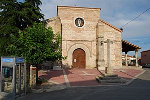
Church of Santa María del Castillo
|
|||
|
|||
| Country | |||
| Autonomous community | |||
| Province | |||
| Municipality | Flores de Ávila | ||
| Area | |||
| • Total | 43.04 km2 (16.62 sq mi) | ||
| Elevation | 898 m (2,946 ft) | ||
| Population
(2018)
|
|||
| • Total | 307 | ||
| • Density | 7.133/km2 (18.47/sq mi) | ||
| Time zone | UTC+1 (CET) | ||
| • Summer (DST) | UTC+2 (CEST) | ||
Flores de Ávila is a small town, also known as a municipality, located in the province of Ávila. This province is part of the Castile and León region in Spain. It is about 164 kilometers (about 102 miles) away from Madrid, the capital city of Spain.
In 2018, about 307 people lived in Flores de Ávila. The town is located at an elevation of 898 meters (about 2,946 feet) above sea level.
Contents
Exploring Flores de Ávila
Flores de Ávila covers an area of 43.04 square kilometers (about 16.6 square miles). It is a quiet place where you can experience the traditional Spanish countryside.
The Church of Santa María del Castillo
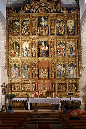
One of the most important buildings in Flores de Ávila is the Church of Santa María del Castillo. This church is a central part of the community. Inside, you can find a beautiful altarpiece. An altarpiece is a large, decorated screen or panel that stands behind the altar in a church. It often features paintings or sculptures.
Location and Geography
Flores de Ávila is situated in a region known for its natural beauty and historical towns. The province of Ávila is known for its mountains and plains.
How to Get There
The town is located in the western part of the Ávila province. You can reach it by road from larger cities like Madrid. The journey offers views of the Spanish landscape.
See also
 In Spanish: Flores de Ávila para niños


