Fort Prince facts for kids
Quick facts for kids Fort Prince |
|
|---|---|
| Wellford, South Carolina, U.S. | |
| Coordinates | 34°58′08.4″N 82°02′56″W / 34.969000°N 82.04889°W |
| Height | 15 ft. |
| Site information | |
| Controlled by | James Steen |
| Site history | |
| Built | 1756-1761 |
| Materials | Timber |
| Battles/wars | Battle of Fort Prince |
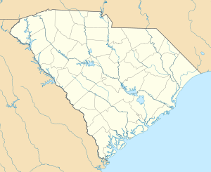
Fort Prince was an important fort built in Spartanburg County, South Carolina. It was made to protect settlers from attacks, especially from the Cherokee people. The fort was a safe place where people gathered when there was danger. It was close to a creek for water and a mill to grind corn. During the American Revolutionary War, a battle happened here on July 15, 1780. Edward Hampton led American forces to push the British out of the fort. The fort stood for several years after this battle.
How Fort Prince Looked
Fort Prince was built in a round shape. It was made from heavy logs. The fort was about 150 feet (46 meters) wide. It stood about 15 feet (4.6 meters) tall. Small openings called "port holes" were cut into the walls. These were for riflemen to shoot from. A ditch surrounded the fort. The dirt from the ditch was piled against the walls. This made the walls even stronger.
In 1777, Captain James Steen was in charge of Fort Prince. He was later promoted to lieutenant colonel by 1780.
Where Was Fort Prince Located?
People have described the fort's location in different ways. These descriptions were written many years after the fort existed.
One idea places the fort about 2.5 miles (4 km) northeast of Fair Forest village. This spot is on Fairforest Creek, which flows into the Tyger River. This might be an older fort with a similar name. A new lake covered this possible location in 1971.
Another description says the fort was southwest of Union, South Carolina. It was where road SC49 crosses Fairforest Creek. This spot was on a high piece of land next to Gray's Creek.
The Blackstock Road ran next to the fort. This road met the road to Earlesville, which is now Landrum, South Carolina. To the southeast, Blackstock Road became Charles Town Road.
An old map from 1858, called the Geognostic Map of Spartanburg District, shows the site of Fort Prince. It places the fort on Blackstock Road near the North Tyger River and Nazareth Church. You can find this map in the South Carolina Archives.
Fort Prince Historical Marker
There is a marker for Fort Prince near a cemetery. To find it, take I-85 to Exit 68. Then, go south on Highway 129 towards Greer. Take the first right turn onto Fort Prince Road. Go about a quarter mile (0.4 km) on Fort Prince Road. The cemetery will be on your left. A marker from the D.A.R. is in a cornfield nearby. Across Highway 129 from the cemetery, there is another marker. The Wellford Bicentennial Committee put it there in 1977.
 | George Robert Carruthers |
 | Patricia Bath |
 | Jan Ernst Matzeliger |
 | Alexander Miles |


