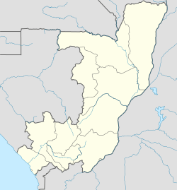
Gamboma facts for kids
Quick facts for kids
Gamboma
|
|
|---|---|
| Country | |
| Department | Plateaux Department |
| District | Gamboma District |
| Elevation | 354 m (1,161 ft) |
| Population
(2018)
|
|
| • Total | 26,053 |
Gamboma is a town located in the Plateaux Department of the Republic of the Congo. This country is in Central Africa. Gamboma is an important place in its region.
Contents
Location and Size
Gamboma is found in the central part of the Republic of the Congo. It is part of the Plateaux Department. The town sits at an elevation of about 354 meters (1,161 feet) above sea level. This means it's quite a bit higher than the coast.
Population of Gamboma
In 2018, about 26,053 people lived in Gamboma. This makes it one of the larger towns in the Plateaux Department. Knowing the population helps us understand the size and importance of the town.
Getting Around: Gamboma Airport
Gamboma has its own airport, called Gamboma Airport. An airport is a very important part of a town's infrastructure. It helps people and goods travel to and from the town. This connects Gamboma to other parts of the country and even the world.
Gamboma's Climate
The climate in Gamboma is generally warm all year round. It experiences a tropical climate. This means it has high temperatures and a lot of rain during certain months.
Temperature in Gamboma
The average high temperature in Gamboma is around 31 to 32 degrees Celsius (88 to 90 degrees Fahrenheit). The warmest months are usually March and April. Even in the cooler months, temperatures stay high.
Rainfall in Gamboma
Gamboma has a wet season and a drier season. The wettest months are from November to May. During these months, the town gets a lot of rain. The drier months are June, July, and August. Even then, some rain can still fall.
| Climate data for Gamboma (1991-2020) | |||||||||||||
|---|---|---|---|---|---|---|---|---|---|---|---|---|---|
| Month | Jan | Feb | Mar | Apr | May | Jun | Jul | Aug | Sep | Oct | Nov | Dec | Year |
| Mean daily maximum °C (°F) | 31.6 (88.9) |
32.1 (89.8) |
32.6 (90.7) |
32.6 (90.7) |
32.1 (89.8) |
31.4 (88.5) |
30.8 (87.4) |
31.5 (88.7) |
31.5 (88.7) |
31.1 (88.0) |
31.2 (88.2) |
31.0 (87.8) |
31.6 (88.9) |
| Average precipitation mm (inches) | 174.0 (6.85) |
179.8 (7.08) |
216.3 (8.52) |
241.8 (9.52) |
184.1 (7.25) |
43.6 (1.72) |
14.0 (0.55) |
30.8 (1.21) |
109.8 (4.32) |
212.4 (8.36) |
299.1 (11.78) |
214.2 (8.43) |
1,919.9 (75.59) |
| Source: NOAA | |||||||||||||
 | Jessica Watkins |
 | Robert Henry Lawrence Jr. |
 | Mae Jemison |
 | Sian Proctor |
 | Guion Bluford |


