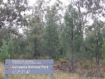
Garrawilla National Park facts for kids
Quick facts for kids Garrawilla National ParkNew South Wales |
|
|---|---|
|
IUCN Category II (National Park)
|
|

Garrawilla National Park
|
|
| Nearest town or city | Coonabarabran |
| Area | 9.37 km2 (3.62 sq mi) |
| Managing authorities | New South Wales National Parks and Wildlife Service |
| See also | Protected areas of New South Wales |
Garrawilla National Park is a special protected area in New South Wales, Australia. It was officially created in December 2005. This park covers a large area of 937 hectares. To give you an idea, that's like more than 900 football fields! You can find it on the northern side of the Oxley Highway. It's located roughly halfway between the towns of Coonabarabran and Mullaley.
About Garrawilla National Park
Garrawilla National Park is a place set aside to protect nature. It was established to keep its natural environment safe. The park officially opened in December 2005. It helps protect the plants and animals that live there. The New South Wales National Parks and Wildlife Service looks after the park. They make sure it stays wild and healthy for everyone.
Where is Garrawilla National Park?
This national park is located in the state of New South Wales, Australia. You can find it on the northern side of the Oxley Highway. If you are traveling between Coonabarabran and Mullaley, the park is about halfway. Its exact coordinates are 31°6′46″S 149°38′20″E.


