Glenview Creek facts for kids
|
|
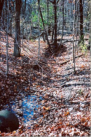
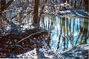
Glenview Creek is a small stream located in Glenview, Illinois, a village in Cook County, Illinois. It starts near Glenview Road, next to an old railroad line. The creek flows west for about three-quarters of a mile. It then joins the Middle Fork of the North Branch of the Chicago River in a place called Harms Woods.
Most of Glenview Creek now flows underground in large pipes. Only small parts of it can still be seen on the surface.
Contents
Glenview Creek's Original Path
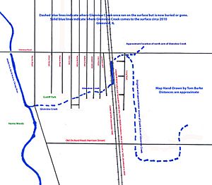
Long ago, Glenview Creek was much longer and flowed mostly above ground. A map from 1910 shows that the creek had several branches.
Southern Branch
One branch started near where the Edens Expressway and Old Orchard Road are today. This area was farmland back then. This southern branch was called a ditch. It crossed Harrison Street (now Old Orchard Road) twice before flowing north. It then met the main part of the creek near Glenview Road.
Northeastern Branch
Another branch came from the northeast. It flowed southwest and joined the southern branch at Glenview Road.
Railroad Crossings
The Chicago & North Western (C&NW) railroad tracks crossed over the creek on a wooden bridge, called a trestle. This trestle was about four feet high. Later, around 1926, the Chicago North Shore and Milwaukee Railroad (CNS&M) also built a parallel line with its own trestle over the creek. Old photos from the C&NW clearly labeled the stream as "Glenview Creek."
Why Glenview Creek Went Underground
In the 1930s, there were plans to put Glenview Creek into underground pipes, called storm sewers. This was done for a few reasons.
Creating Jobs
During the Great Depression, many people needed work. The Village of Glenview applied for help from the Works Progress Administration (WPA). This was a government program designed to create jobs. In 1935, a newspaper article mentioned that extending the village's sewer system would employ many men. They would dig ditches for the new pipes.
Improving Drainage
Another reason was to improve drainage in the eastern part of Glenview. Putting the creek into sewers would help develop the area for homes. The WPA project was approved by 1936. About 35 men were hired to channel the creek's water into the new storm sewers. This work helped control water flow and prevent flooding.
Where it Disappeared
By the mid-1960s, the wooden railroad trestles were replaced with large concrete pipes, called culverts, covered by earth. The creek in this area, between the two railroad lines, used to be clear and had ferns along its banks. Today, Glenview Creek only appears above ground in a few spots. You can see it in ditches near Long Road on the far east side of Glenview. It also comes out from under Harms Road and flows for about 150 feet before joining the Chicago River.
Glenview Creek on Maps
Even after much of Glenview Creek went underground, it still appeared on maps.
- A 1980 map from the United States Geological Survey (USGS) showed the gentle valley that the underground creek had carved out. It even showed where its old branches used to be.
- An older map from the Glenview Public Library, likely from the early 1950s, showed Glenview Creek flowing on the surface all the way to the Chicago River. This map might have been made before all the work to bury the creek was finished.
- The creek also appears on a map in a book called Route of the Electroliners. It shows where the creek crossed the Skokie Valley Line of the CNS&M railroad near the Glenayre train station.
The 2008 Flood
On September 13, 2008, very heavy rains caused a "100-year flood." This means it was a very rare and large flood. Water from the Middle Fork of the North Branch of the Chicago River backed up. It flowed all the way east up the original valley of Glenview Creek to Laramie Avenue. This showed how the old creek path still affects water flow, even when the creek is underground.
 | William L. Dawson |
 | W. E. B. Du Bois |
 | Harry Belafonte |


