
Golden Gate Mining and Town Complex facts for kids
Quick facts for kids Golden Gate Mining and Town Complex |
|
|---|---|
.jpg)
Timber stump mounts for vat at Croydon Consols Cyanide Plant, 2005
|
|
| Location | Normanton Road (Gulf Developmental Road), Croydon, Shire of Croydon, Queensland, Australia |
| Design period | 1870s–1890s (late 19th century) |
| Built | 1886 |
| Official name: Golden Gate Mining and Town Complex, Golden Gate Township, Croydon Consols Pump Shaft, Golden Gate No.10 North Mine, Golden Gate Cemetery, Croydon Consols Battery and Cyanide Plant, Golden Gate Mine | |
| Type | archaeological (landscape) |
| Designated | 14 August 2009 |
| Reference no. | 700005 |
| Significant period | 1891–1922 |
| Lua error in Module:Location_map at line 420: attempt to index field 'wikibase' (a nil value). | |
The Golden Gate Mining and Town Complex is an old mining area and town in Queensland, Australia. It's a special place because it shows us what life was like during the gold rush. This area started in 1886 and is now protected as a heritage site. It is also known by names like Golden Gate Township and Golden Gate Mine.
Contents
- History of Golden Gate
- What Remains Today
- Rogers' No. 1 Golden Gate Mine Remains
- No. 3 and 4 South Golden Gate Mine and Mill, and Morgan's Shaft Remains
- Golden Gate Consols Mine Remains
- Croydon Consols Battery and Cyanide Plant Remains
- Croydon Consols Pump Shaft Remains
- Golden Gate No. 10 North Mine Remains
- Golden Gate Township Remains
- Golden Gate Cemetery Remains
- Other Domestic Remains
- Why Golden Gate is Important
History of Golden Gate
Gold was first found at the Golden Gate reef in 1886. A "reef" is a vein of rock that contains gold. Miners started digging, but then stopped for a short time in 1887. They came back in 1891, and mining continued until 1915.
The Golden Gate reef turned out to be the richest gold source in the area. Many mines opened here, like Golden Gate No.1 and Croydon Consols. The town of Golden Gate was officially mapped out in 1893, but buildings were already there. The town slowly became empty and was completely deserted by 1922.
The Croydon Goldfield
The very first gold finds in the Croydon area were made by a farmer named William Brown in 1883. More gold was soon found around the growing town of Croydon. On January 18, 1886, the area was officially declared the Croydon Goldfield.
By the end of 1886, about 2,000 people lived there. In 1887, the population grew to around 6,000 people. At this time, the Croydon goldfield produced the second-highest amount of gold in Queensland, after Charters Towers.
Some mines near Croydon town faced problems around 1890. However, new rich gold discoveries in 1891 at the Golden Gate reef helped the area. The 1890s were the best years for the Croydon Goldfield. Most mining companies were local, and a stock exchange was even set up in Croydon in 1892.
The town of Croydon became the main center for the goldfield. Smaller towns grew up near other gold reefs, like Golden Gate, Tabletop, and Gorge Creek.
Golden Gate Reef Discoveries
The first claim on the Golden Gate reef was made by Joseph Hardy and James Fulton in April 1886. But not much gold was found until 1891. That's when a very rich gold vein was discovered in Rogers' No. 1 Golden Gate mine.
The Golden Gate reef was about 2.5 kilometers long and contained gold mixed with other minerals. Most of the gold was found within about 90 meters of the surface. Between 1886 and 1911, this reef produced over 483,000 ounces of gold. This was more than one-third of all the gold found in the entire Croydon area!
Important mines in the Golden Gate area included Golden Gate Nos. 5, 7, and 10, Golden Gate United, and Golden Gate Consols. Even though Golden Gate was still producing a lot of gold in 1900, the overall goldfield was starting to decline. Miners tried to find new gold veins deeper underground, but they weren't successful. Gold production slowed down before World War I, and most mining stopped by 1915.
Rogers' No. 1 Golden Gate Mine
Rogers' No. 1 Golden Gate mine was one of the three biggest mines on this gold line. James Rogers, who owned and developed several mines here, was also the mayor of Croydon. In 1894, Rogers received money from the government to dig deeper. This paid off in 1896 when a rich find at 36.5 meters deep produced 3,800 ounces of gold.
In 1897, the reef was found to be three meters wide. That year, the mine produced 12,560 ounces of gold. This success helped sell the Golden Gate No. 1 mine to an English company. Rogers received a share of the company. The new company planned to spend a lot of money on machinery and further digging.
In 1900, the mine produced 3,947 ounces of gold. It used two steam engines, winding gear, and a steam pump. By 1902, more machinery was added, including three steam engines. The mine kept 15 crushing stamps busy at the Golden Gate mill. In 1906, Rogers' Golden Gate was the biggest producer on the Golden Gate line.
No. 3 and 4 South Golden Gate Mine
This mine was one of the most successful in the goldfield, reaching a depth of about 122 meters. In just two years after it started in 1898, it produced 36,296 ounces of gold, worth over £96,000. The ore from this mine was crushed at the Enterprise mill.
This mine produced a total of 91,917 ounces of gold, worth over £238,000. This was the largest amount of gold from any of the Golden Gate mines. However, gold production quickly dropped after 1905.
Golden Gate Consols Mine
This mine was first known as Golden Gate No.8 North. In 1893, a reef found at 26 meters deep produced 363 ounces of gold.
In 1894, an English company bought the mine. The new company improved the mine, making the shaft straighter and adding timber supports. By 1896, the main shaft was 116 meters deep, making Golden Gate Consols the deepest mine in the area. That year, the mine produced 22,815 ounces of gold. This allowed the company to pay out £28,000 to its shareholders, which was more than any other mine on the Croydon goldfield had done before.
In September 1900, a rich new gold vein was found. This mine continued to be one of the top producers on the Croydon Goldfield for the next ten years.
Croydon Consols Battery and Cyanide Plant
The gold ore from the Golden Gate mines was first crushed at the Enterprise battery. The Croydon Consols battery, also called Richardson's mill, used a steam engine and 15 crushing stamps. In 1900, it was worth £3,000. The next year, it doubled in size with a larger steam engine and 30 crushing stamps.
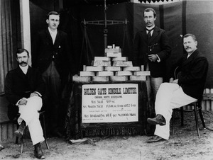
The process of using cyanide to get gold from leftover crushed rock (called tailings) started in the Croydon Goldfield in 1894. The Croydon Consols cyanide plant operated between 1897 and 1904. During this time, it treated 9,500 tons of tailings and produced 7,000 ounces of gold. In 1897, the plant had a steam engine, ten large vats, and several pumps.
Croydon Consols Pump Shaft
As the mines got deeper, they often filled with water. This made mining very difficult and expensive. To solve this problem, a large pump was built at the Croydon Consols mine in 1898.
After a huge flood in the Golden Gate Consols mine in 1898, the owners ordered pumping equipment from a company in Maryborough. The powerful pump started working in February 1899. By 1901, the plant included winding gear, three steam engines, six pumps, and an air compressor. It was the most advanced pumping equipment on the goldfield. This pump also supplied water to the Golden Gate Milling Company. The pumping equipment was used until the mine closed in 1911.
Golden Gate No.10 North Mine
It's not clear when the Golden Gate No.10 mine started, but it appeared on maps by 1896. This mine was at the northern end of the gold reef. Miners dug many shafts here, hoping to find more gold.
In 1923, the Golden Gate No.10 North mine was worked again. Miners tried to pump out water and find the gold reef again. A small amount of gold was found that year, but there are no more records after this time.
Morgan's Shaft
H.F. Morgan started a mining company in 1899 after finding gold at Golden Gate No. 4 and 5 South Block. His shaft was dug through 1900. In 1901, it hit water, and they had to constantly pump it out. A powerful pump was installed.
In 1902, the shaft reached the Golden Gate reef at 146 meters deep. However, the gold found there was not profitable. The shaft mainly served to pump water out of the area. Other nearby mines helped pay for the pumping, as their mines would also flood otherwise. The shaft continued to be used until 1914, but the water flow became too much to handle.
Township of Golden Gate
The town of Golden Gate was about 8 kilometers northwest of Croydon. It was officially surveyed in April 1893, but buildings were already there. Golden Gate was one of several smaller towns that grew up around the main center of Croydon. People from these smaller towns would visit Croydon on Saturday nights to shop and socialize.
A railway station opened at Golden Gate in 1891 when the Normanton to Croydon railway started. By 1894, the small town had 250 people, growing to 600 by 1900. It had 11 hotels, stores, churches, butchers, and other businesses. A school operated from 1896 to 1921, and a post office from 1891 to 1919. As gold production dropped before World War I, the town's population also declined. It became even smaller after a mill closed in 1922.
Golden Gate Cemetery
The Golden Gate Cemetery is one of at least ten cemeteries that served the Croydon area. It is located next to the Golden Gate Township, west of the railway. It was likely used from the mid-1880s until a new cemetery was opened in 1900. There are believed to be 19 graves in the cemetery. Only two graves have iron railings, and two have sandstone borders.
What Remains Today
.jpg)
The Golden Gate Mining and Town Complex is about 8 kilometers northwest of Croydon. It is next to the historic Normanton-Croydon railway line. The site includes what's left of many mines, a mill, a pump shaft, the old town, and the cemetery.
Rogers' No. 1 Golden Gate Mine Remains
This mine is located south of the Golden Gate Consols Mine. In 1992, parts of a brick chimney, a boiler, and foundations for a winding engine were still there.
No. 3 and 4 South Golden Gate Mine and Mill, and Morgan's Shaft Remains
Located at the southern end of the complex, this site still has parts of a boiler, engine remains, and foundations for the boiler and mill. You can also see winding engine parts, tanks, a shaft, and piles of waste rock (mullock heaps).
Golden Gate Consols Mine Remains
This mine is north of the Gulf Developmental Road. It has a shaft, a large pile of waste rock, retaining walls, winding plant parts, boilers, a chimney base, and old ship's tanks.
Croydon Consols Battery and Cyanide Plant Remains
This area has two main parts: a battery site and a cyanide plant. The battery site includes boilers, concrete and stone foundations, and steam engines. An old tramway path runs south from the battery.
The cyanide plant is about 150 meters south of the battery. There's a large pile of tailings (waste from gold processing) that covers much of the old Golden Gate Township. You can still see parts of the tailings bucket chains, a boiler, an engine, timber foundations, and concrete ponds.
Croydon Consols Pump Shaft Remains
This pump shaft is northwest of the Croydon Consols cyanide plant. It has a high pile of waste rock. The site includes what's left of a shaft, a pump arm, concrete and log mounts, engine parts, a winding unit, and a boiler.
Golden Gate No. 10 North Mine Remains
This mine is on the western bank of Golden Gate Creek. What remains includes the mine shaft, steam engines, a winding unit, and boilers.
Golden Gate Township Remains
The center of the old town was on the north side of the railway. Some parts are now covered by the modern road and farm tracks. The large tailings dump from the mines also covers much of the former town.
You can find signs of old homes at the southern end of the Golden Gate Consols mine site. No full buildings are left, but you can see earth floors, stone foundations, and pieces of corrugated iron walls. There are also broken glass bottles, bricks, stove parts, and old tins.
Golden Gate Cemetery Remains
The Golden Gate Cemetery is southwest of the railway and the old town. It's about 230 meters west of the Gulf Developmental Road. There are thought to be 19 graves here. Only two graves have iron railings, and two have sandstone borders.
Other Domestic Remains
You can find other signs of old homes outside the main town area. For example, at the southern end of the site, there are many old glass bottles, bricks, and metal items. There are also some stone and concrete structures that might have been steps.
Why Golden Gate is Important
The Golden Gate Mining and Town Complex was added to the Queensland Heritage Register on August 14, 2009. This means it's a very important historical site.
The complex has old mine workings, a battery (for crushing ore), a cyanide plant (for extracting gold), a town, and a cemetery. It can teach us a lot about early gold mining and how towns grew in North Queensland. The Golden Gate Reef was the most productive gold source in the Croydon area, and this site shows how gold mining developed there.
The site has many archaeological remains from gold mining and processing. It has some of the largest collections of old boiler and steam engine parts found in North Queensland. The cyanide plant is one of the oldest and most complete in the region. The old tailings bucket chains and the supports for the vats are very rare to find today. The site also has a very rare type of steam engine and the only remaining beam pump arm in the Georgetown-Croydon area.
Archaeologists have found many old items like glass bottles, bricks, and ceramics in the old town site. These items help us understand daily life there. The cemetery also has important physical evidence, like iron railings and sandstone grave markers.
Studying the Golden Gate site helps us understand how gold mining operations worked in the past. It shows how the mines, machinery, and town were connected. This research can also be compared to other gold mining sites in the Croydon area.
Archaeological studies at Golden Gate can answer important questions about how the community started, grew, traded, and eventually declined. It can show us how mining, homes, and businesses were organized. By looking at the whole area, including old roads and railways, we can learn about the connections between Golden Gate and Croydon.
Researching the cemetery at Golden Gate can tell us about the social life of the community. By looking at the types of graves and how they are arranged, we can learn about different groups of people, their beliefs, and how society was organized. Studying the remains of those buried there can also give us clues about their health and living conditions.
The Golden Gate Mining and Town Complex can also help us learn about groups of people who might not be well-described in historical records. For example, archaeological digs can show the presence of Chinese people in mining and other businesses. It might also reveal how Aboriginal people interacted with the Golden Gate community. Studying the remains of different ethnic groups, like Irish or Scottish miners, can help us understand the social dynamics of mining communities in Queensland.
There is still much more to learn from the Golden Gate Mining and Town Complex through archaeological research.
