Grappes Bluff, Louisiana facts for kids
Quick facts for kids
Grappes Bluff
|
|
|---|---|
| Country | United States |
| States | Louisiana |
| Parish | Natchitoches |
| Elevation | 154 ft (47 m) |
| Time zone | UTC-6 (Central (CST)) |
| • Summer (DST) | UTC-5 (CDT) |
| GNIS feature ID | 554588 |
Grappes Bluff is a small place in Louisiana, a state in the United States. It's known as an unincorporated community. This means it's a group of homes or buildings that isn't officially a town or city with its own local government.
Contents
What is an Unincorporated Community?
An unincorporated community like Grappes Bluff doesn't have its own mayor or city council. Instead, it's part of a larger area. For Grappes Bluff, this larger area is Natchitoches Parish.
How Does it Work?
- People living in Grappes Bluff get their services from the parish or county government.
- These services include things like roads, police, and fire protection.
- It's different from a city, which has its own rules and services.
Where is Grappes Bluff Located?
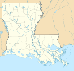
Grappes Bluff is found in the central part of Louisiana. It's in Natchitoches Parish, which is one of Louisiana's oldest areas.
Nearby Connections
The community was located close to Louisiana Highway 480. Highways are important roads that connect different places. This highway would have helped people travel to and from Grappes Bluff.
Black History Month on Kiddle
African-American Labor Activists
 | Bayard Rustin |
 | Jeannette Carter |
 | Jeremiah A. Brown |

All content from Kiddle encyclopedia articles (including the article images and facts) can be freely used under Attribution-ShareAlike license, unless stated otherwise. Cite this article:
Grappes Bluff, Louisiana Facts for Kids. Kiddle Encyclopedia.


