Guarumal, Chiriquí facts for kids
Quick facts for kids
Guarumal
|
|
|---|---|
|
Corregimiento
|
|
| Country | |
| Province | Chiriquí |
| District | Alanje |
| Area | |
| • Land | 83.3 km2 (32.2 sq mi) |
| Population
(2010)
|
|
| • Total | 2,418 |
| • Density | 29/km2 (80/sq mi) |
| Population density calculated based on land area. | |
| Time zone | UTC−5 (EST) |
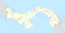
Guarumal is a special kind of area in Panama, a country in Central America. It's called a corregimiento, which is like a local administrative division, similar to a small district or a large neighborhood. Guarumal is located in the Chiriquí Province, specifically within the Alanje District.
Contents
What is Guarumal?
Guarumal is one of the many corregimientos that make up Panama. Think of it as a local community with its own boundaries and a group of people living there. These areas help organize the country and its services.
Where is Guarumal located?
Guarumal is found in the western part of Panama. It's part of the Chiriquí Province, which is known for its beautiful landscapes, including mountains, rivers, and coastal areas. The Alanje District, where Guarumal is, is a smaller part of this province.
How big is Guarumal?
Guarumal covers a land area of about 83.3 square kilometers (about 32.2 square miles). To give you an idea, that's roughly the size of a medium-sized city.
People of Guarumal
The number of people living in Guarumal has changed over the years.
Population changes over time
- In 1990, about 1,800 people lived in Guarumal.
- By 2000, the population grew to 2,092 people.
- In 2010, the most recent count, there were 2,418 residents.
This shows that more people have been choosing to live in Guarumal over time.
How many people per square kilometer?
In 2010, the population density was about 29 people per square kilometer (or 75 people per square mile). This number tells us how crowded an area is. Guarumal is not very crowded, suggesting it might have more open spaces compared to a big city.
See also
 In Spanish: Guarumal (Chiriquí) para niños
 | Janet Taylor Pickett |
 | Synthia Saint James |
 | Howardena Pindell |
 | Faith Ringgold |


