Harshaville, Ohio facts for kids
Quick facts for kids
Harshaville, Ohio
|
|
|---|---|
| Country | United States |
| State | Ohio |
| County | Adams |
| Elevation | 725 ft (221 m) |
| Time zone | UTC-5 (Eastern (EST)) |
| • Summer (DST) | UTC-4 (EDT) |
| Area code(s) | 937, 326 |
| GNIS feature ID | 1064803 |
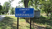
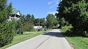
Harshaville, Ohio (sometimes called Harshasville) is a small, unincorporated community in Adams County, Ohio, USA. This means it's a group of homes and businesses that isn't officially a town or city. It's located in the southern part of the state of Ohio.
Contents
History of Harshaville
Harshaville grew up around an important building called the Harsha Mill. This was a gristmill, which is a type of mill that grinds grain into flour. The mill was powered by the Cherry Fork Creek, using the water's movement to turn its machinery.
How Harshaville Got Its Name
The community was named after the local Harsha family, who likely owned or operated the mill. In 1865, a post office was opened in Harshaville. This was a big deal because it made it easier for people to send and receive mail. The post office served the community for many years before it closed in 1909.
Harshaville Covered Bridge
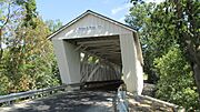
Harshaville is home to a special landmark called the Harshaville Covered Bridge. This historic bridge is very old and has a roof and sides, which protect the wooden structure from the weather.
A Historic Landmark
The Harshaville Covered Bridge is so important that it is listed on the National Register of Historic Places. This means it's recognized as a significant historical site in the United States. It's a great example of old-time engineering and a piece of local history.
Gallery
 | Sharif Bey |
 | Hale Woodruff |
 | Richmond Barthé |
 | Purvis Young |


